
“Nature is not a place to visit,” Gary Snyder once wrote. “It is home.” Yet when home is shadowed by a volcano with a violent past, that truth feels more complicated. Of late, Mount Rainier has been thrust into headlines, painted as a restless giant on the verge of waking. For the millions living in its shadow, the idea of an eruption-whether tomorrow or decades from now-is more than a geological curiosity: it’s a matter of safety, infrastructure and survival.
The story is tangled. On the one hand, seismic readings seemed to show an unprecedented, days-long volcanic tremor. On the other, experts quickly pointed to a far less dramatic culprit: faulty equipment. Yet the incident has re-ignited conversations about Rainier’s history, its deadly potential, and the meticulous work scientists and communities are doing to prepare for the worst. Here’s what’s most important to know right now.
1. The ‘Unprecedented Tremor’ That Wasn’t
Reports of a continuous, high-energy tremor beneath Mount Rainier washed over social media and news outlets. Seismographs recorded at the St. Andrews Rock station showed dense, continuous signals for over 72 hours-patterns that can be indicative of magma, gas or hot water moving beneath a volcano. But the PNSN sorted out the cause in short order: radio interference, probably because of ice accumulation on the station’s antenna. “Stations go out all the time,” PNSN Director Harold Tobin told KIRO 7. “That’s why we operate hundreds of them.” Instruments in the vicinity were not recording similar activity, confirming no actual rise in volcanic unrest was occurring.

2. Why Mount Rainier Still Tops the Danger List
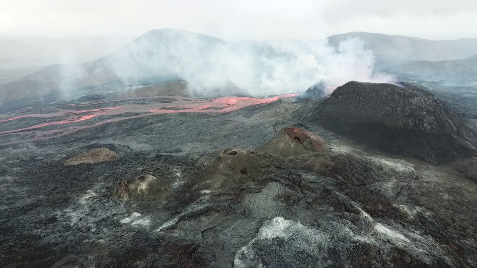
Even without an active eruption, Rainier is rated by the USGS as having a “Very High” long-term threat. The hazard does not come simply from lava or ash, but also from lahars – fast-moving volcanic mud flows that have been known to destroy whole communities in a matter of minutes. Rainier’s massive ice cap and unstable slopes make it particularly prone to such flows. Geologic records show at least 11 large lahars have surged into the Puget Lowlands in the past 6,000 years, some reaching over 50 miles from the volcano.
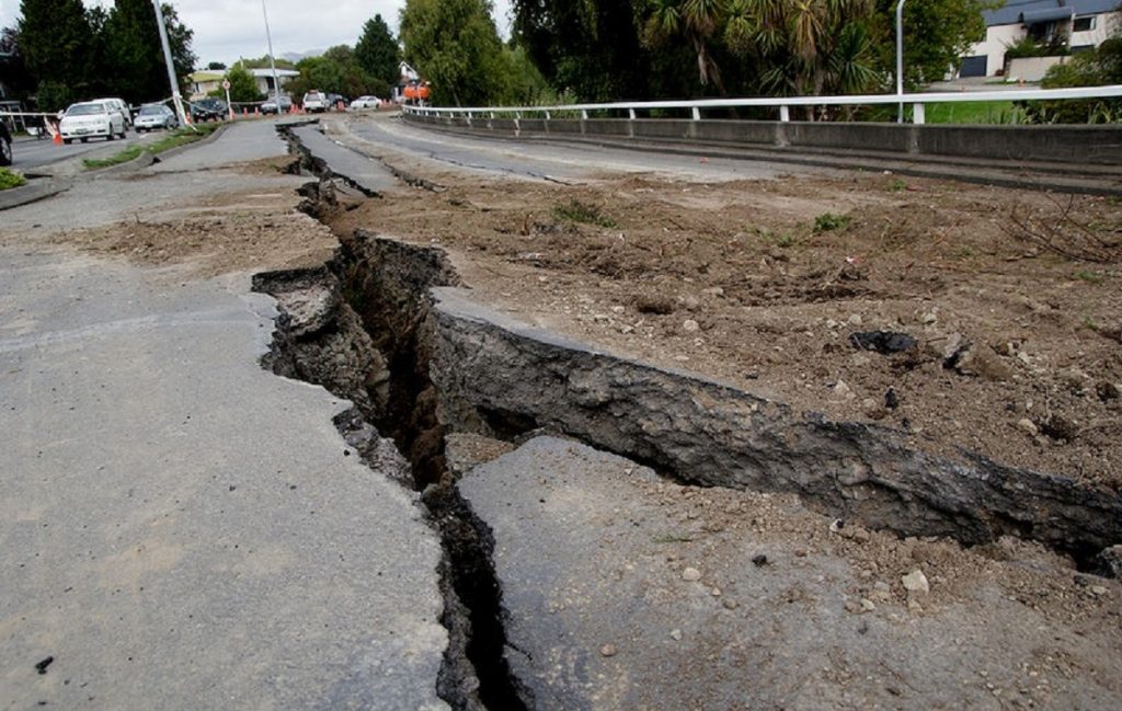
3. Lahars: The Real Killer
A lahar is a churning mix of mud, water, rock, and debris that can barrel down valleys at highway speeds. At Rainier, melting snow and ice can feed these flows during eruptions or even without one, as happened with the Electron Mudflow about 500 years ago. That event, likely triggered by a landslide, is a stark reminder that a “no notice lahar” could give nearby communities just tens of minutes to evacuate. With over 90,000 people living in mapped lahar hazard zones, the stakes are enormous.
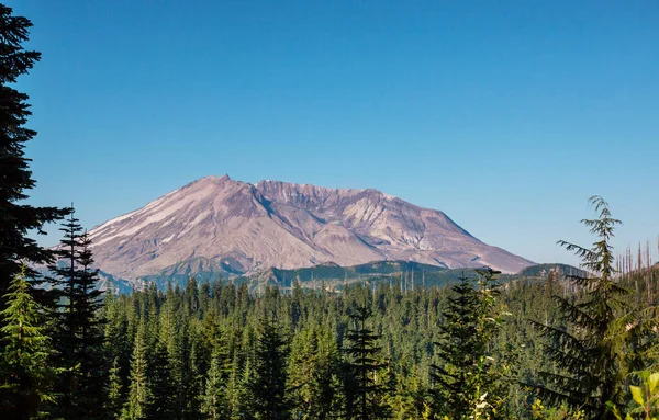
4. The 1980 Mount St. Helens Lesson
The eruption of Mount St. Helens, only 50 miles south of Rainier, remains a blueprint for understanding Cascade volcano hazards. On May 18, 1980, a 5.2 magnitude quake triggered a colossal landslide that uncorked magma with the force of 1,500 Hiroshima bombs. The blast killed 57 and loosed a lahar that destroyed more than 200 homes and over 185 miles of roads. Scientists learned even given months of warning, forecasting the exact instant of eruption is riddled with uncertainty.
5. The July 2025 Earthquake Swarm
Earlier this year, Rainier saw the largest quake swarm ever recorded–over 1,000 small quakes from July 8 through the end of the month. At one point, instruments were recording as many as 41 quakes an hour. Most were small, but the swarm greatly eclipsed the previous record from 2009, which only lasted three days and produced about 120 quakes. Such swarms can signal magma movement, but they can also occur and not be followed by an eruption.
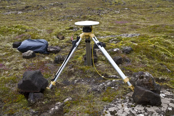
6. Advanced Monitoring Technology
Since the 1980s, the science of volcano monitoring has leapt forward. Today, GPS, satellite imagery, and even drones sampling volcanic gases give scientists near-real-time insights into a volcano’s behavior. Rainier is wired with seismic stations, GPS receivers, and lahar detection systems. The PNSN operates hundreds of sensors across the region-meaning that a single faulty station, like the one this week, does not trigger false alarms about volcanic unrest.
7. The World’s Largest Lahar Drill
On March 21, 2024, upwards of 45,000 students living in communities south of Seattle conducted the largest lahar evacuation drill in history. Organized by the East Pierce Interlocal Coalition, the drill modeled a mass movement of people out of hazard zones. In Orting itself, where a lahar would arrive as quickly as 50 minutes, 13,000 students walked as many as two miles to safe zones the others sheltered in place, demonstrating preparedness for multiple eventualities.
8. The ‘No Notice’ Threat
Not all lahars give any warning. The west flank of Rainier still has enough weakened rock to produce a major flow without an eruption. Such an event could be preceded by a landslide, giving communities just minutes to act. That’s why lahar sirens, automatic alerts, and planning for evacuation routes are crucial parts of regional preparations.

9. Why Public Communication Matters
While false alarms might undermine public trust, they can also raise worthy discussions about preparedness. Transparency is key, said Tobin, explaining why an anomaly is not a real threat but again reaffirming the importance of vigilance. As Steve Malone, a veteran volcanologist, has said, “Our role is not only to do science and teach students but also to provide information to the public.
That’s a very serious responsibility.” This week’s seismic buzz proved to be not a geological crisis but rather a technological hiccup. Still, the potent reminder is that Mount Rainier’s hazards are real, and its history is violent, while its future will require preparation. For now, the mountain may be quiet, but it will be the systems, drills, and vigilance in place that make a difference when it’s not.


