What’s more unsettling a barrage of small storms or just a handful of record‑breaking monsters? The 2025 Atlantic hurricane season answered that question with unnerving clarity. It delivered fewer storms than average, yet the ones that did form often roared into the highest categories, rewriting record books and testing forecasting skill.
From the season’s opening in June to its close in late November, the Atlantic basin swung between eerie calm and explosive fury. The United States dodged a hurricane landfall for the first time in a decade, even as Jamaica endured the strongest landfalling hurricane in Atlantic history. Scientists, forecasters, and coastal communities are now parsing what this unusual mix of scarcity and severity means for the future.
Below are nine key takeaways from a season that will be remembered for its extremes, its surprises, and its warnings.
1. A Rare Year Without U.S. Hurricane Landfalls
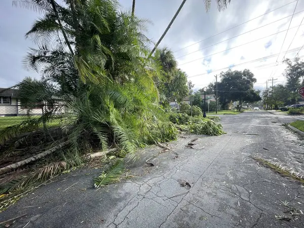
For the first time since 2015, no hurricane made landfall in the continental United States. Only Tropical Storm Chantal came ashore, striking South Carolina in early July with flooding rains that caused at least four deaths and $500 million in damage. Historically, the U.S. averages about two hurricane landfalls per year, and the last five years had seen only major hurricanes making landfall. Meteorologists attribute 2025’s reprieve to a persistent upper‑level trough over the eastern U.S., which weakened the Bermuda High and repeatedly steered storms northward and out to sea before they could reach the mainland.
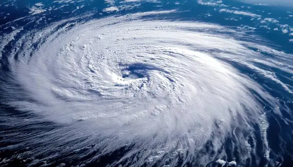
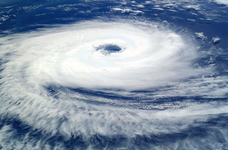
2. Three Category 5 Hurricanes in One Season
Only once before, in 2005, has the Atlantic produced more than two Category 5 hurricanes in a single year. In 2025, Erin, Humberto, and Melissa all reached this pinnacle of intensity. That meant 23% of the year’s named storms hit Category 5 strength, compared with a historical rate of about 3%. Erin’s rapid intensification from 75 mph to 160 mph in 24 hours tied for the fifth‑fastest wind increase on record, while Humberto and Melissa followed with their own explosive strengthening.
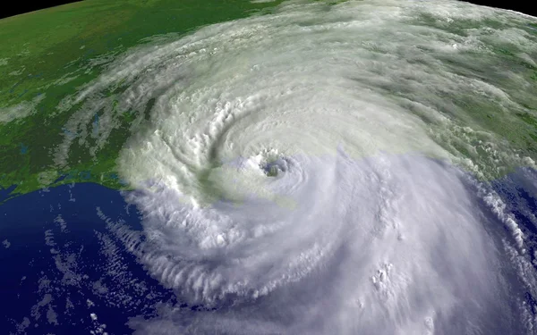
3. Melissa’s Historic and Devastating Landfall
Hurricane Melissa struck Jamaica on October 28 with sustained winds of 185 mph and a central pressure of 892 mb, tying the 1935 Labor Day Hurricane as the strongest landfalling Atlantic hurricane ever recorded. A dropsonde measured a wind gust of 252 mph in its eyewall, the highest ever recorded by such an instrument. The World Bank estimated damages in Jamaica at $8.8 billion about 41% of the nation’s GDP with further severe impacts in Haiti and Cuba. Climate Central’s rapid attribution study found that climate change likely added about 10 mph to Melissa’s peak winds.
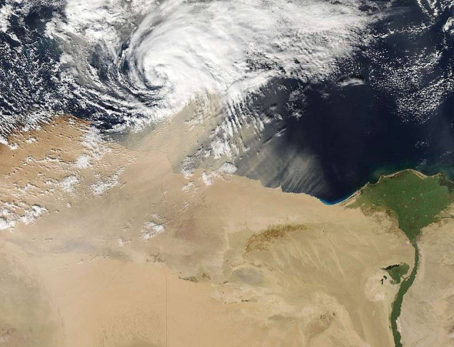
4. The Fujiwhara Effect’s Rare Appearance
On September 30, Hurricanes Humberto and Imelda came unusually close in the North Atlantic, engaging in the Fujiwhara Effect a rare interaction where two cyclones within about 800 miles begin to orbit each other. The larger, stronger Humberto tugged Imelda away from the U.S. coast, sparing it from potential impacts. Such close‑quarters cyclone dances are seldom seen in the satellite era and fascinate meteorologists for the complex steering patterns they reveal.
5. Above‑Average ACE Despite Fewer Storms
The season’s Accumulated Cyclone Energy (ACE) index reached 133, above the Atlantic average of 122.5. ACE measures the combined strength and duration of all storms, offering a fuller picture than storm counts alone. As NOAA’s Matthew Rosencrans explained, ACE is calculated from wind speeds every six hours for each active storm. In 2025, the high ACE value reflected fewer but longer‑lasting and more intense hurricanes four of the five hurricanes reached major status.
6. Why the U.S. Was Spared
Atmospheric steering currents were decisive. A persistent trough of low pressure over the eastern U.S., coupled with a dip in the jet stream, disrupted the usual westward push of the Bermuda High. This pattern repeatedly bent storms northward before they could enter the Gulf of Mexico or strike the East Coast. As Greg Postel of The Weather Channel noted, 2025 may be remembered as “the year of the recurvature,” when hurricanes curved away from land again and again.

7. Climate Change’s Fingerprints on Storm Intensity
Warmer ocean waters, supercharged by human‑driven climate change, provided abundant fuel for rapid intensification. Analyses showed that the extreme warmth beneath Melissa was 500 to 800 times more likely because of climate change. Scientists now observe what models long predicted: while overall hurricane frequency may not rise and could even decline the proportion reaching Category 4 or 5 strength is increasing. In 2025, four of five hurricanes were Category 4 or 5, the highest percentage ever recorded in an Atlantic season.

8. The Global Context of Category 5 Storms
The Atlantic’s surge in Category 5 hurricanes mirrors a broader global trend. From 1970 to 2000, the Atlantic averaged one Category 5 every five years; since 2000, the rate has tripled. Similar spikes in the most intense storms have been seen in the Pacific and Indian Oceans. Scientists link this to hotter sea surfaces, which can boost potential storm intensity by about 10% for every 1°F increase in water temperature.
9. Fewer Storms, Greater Risk Ahead
Climate models suggest that while wind shear and atmospheric dryness may limit the number of storms in future decades, those that do form will have ample energy to become destructive giants. The 2025 season with below‑average hurricane counts but record‑level intensity may be a preview. Natural climate patterns like El Niño and the Atlantic Multidecadal Oscillation will still shape year‑to‑year variability, but the long‑term trend points toward fewer, more dangerous storms.
The 2025 Atlantic hurricane season underscored a paradox: fewer storms can still mean greater danger. The absence of U.S. hurricane landfalls was a stroke of atmospheric luck, not a sign of diminished risk. As ocean heat content climbs and the climate system shifts, the line between a quiet season and a catastrophic one may hinge on just a single storm and whether it finds a path to shore.


