“If the river begins to act like a fire hose unleashed, the concern is not if there is going to be damage, but the amount of damage and the speed at which that takes place,” says one Northwest emergency manager. In the state of Washington during the month of December, the amount has been staggering: levee breaches, closed highways, and an infrastructure approaching the breaking point as the river assaults the infrastructure with atmospheric river storms.
1. Infrastructure Under Siege
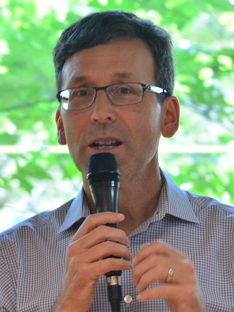
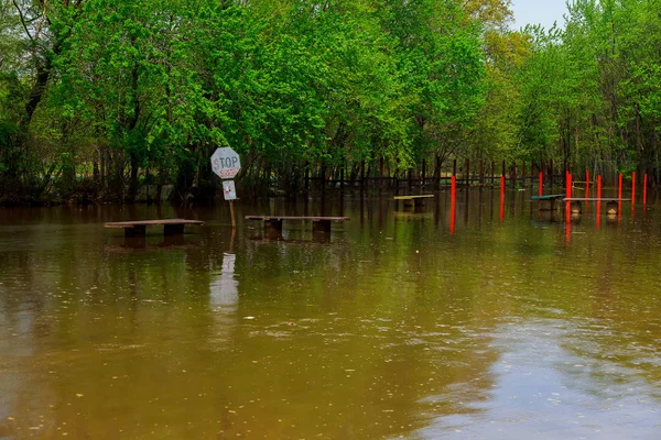
Governor Bob Ferguson’s commentary on the situation summed up the realities of this crisis: “Our infrastructure’s been threatened. There’s a lot of pressure on our infrastructure.” Since the 8th of December, 1,200-plus rescue missions have taken place in 10 counties. Thirteen state highways are closed, including 49 miles of US Route 2 that won’t reopen for several months. Interstate 90, the state’s main east-west highway, experienced closures due to massive mudslides.
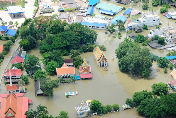
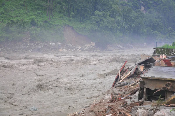
2. Levee Breaches Trigger Mass Evacuations
Levee breaks have displaced thousands of people in King County. In Pacific, where the White River flows, a leak that began with the size of a fire hose grew to 120 feet, said Sheri Badger of King County Emergency Management. Evacuation notices were sent to 1,300 people living in the area. In the city of Tukwila, where the Green River flows, a breach of a 6-foot section of the Desimone levee led to notices sent to 1,100 people before a temporary fix was achieved.
3. Aging Barriers at Their Limits
Many of the levees in the Washington area are outdated and have been band aid-ed numerous times but very rarely repaired. “It’s been a problem for decades, and it’s been a problem that’s been perpetuated by a combination of factors,” said Alan Hamlet, a professor of civil and environmental engineering. The Desimone levee has been repaired several times since 1967 and was identified this year for “serious implications” if it were to fail, yet no budget was allocated for repair.
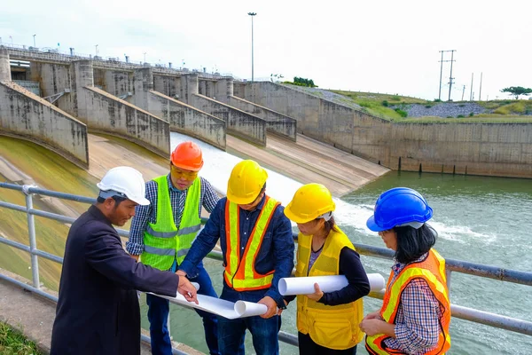
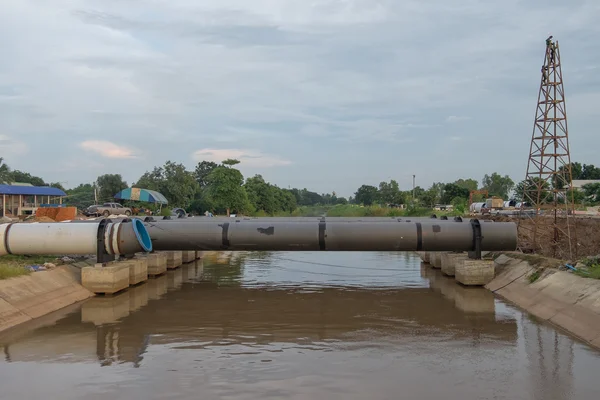
4. Dam Safety Issues
At least two of the dams are being closely monitored. The dam on Lake Sylvia, constructed in 1918, showed the structure to be in “poor” condition with “significant” potential hazard in November 2024. The Tortorice Dam near Sultan experienced a blocked spillway, but a pump installation solved the problem of potential overtopping. The U.S. Army Corps of Engineers reduced the flow of water from the Howard H. Hanson Dam to reduce the flooding but noted it puts the structure more at risk of breaching.
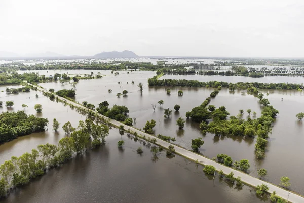
5. Added Fuel to Flood Vulnerability
As Guillaume Mauger, the State Climatologist, has stated, although the recent series of storms have been “big but not historic,” it is the consecutive occurrence that is unusual. “Warmer temperatures lead to more rainfall versus snowfall, and thus more flood-inducing runoff from rivers,” he explained. “A flood event that has historically occurred once per 100 years in the Skagit River basin could increase by almost 50% by the 2080s, making current flood control infrastructure largely ineffective.”
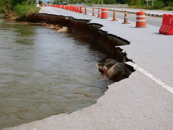
6. Compounding Risks: Landslides and Road Damage
“Soaked soils” have resulted in landslides that damaged roads and left some communities cut off. Parts of Skagit County are under evacuation warnings due to the dangers of both flooding and landslide. Transportation Secretary Julie Meredith has confirmed that there has been extensive damage to the roads that need “complete reconstruction.”

7. The Need for Resilient Solutions
Cas Guillozet of the Bonneville Environmental Foundation made it clear that “more and larger levees are not always the answer.” This can be achieved by setting back levees, rebuilding floodplains, and adopting resilient design in new construction. For every dollar spent on climate resilience, $7 can be saved in recovery expenditures. Schemes to remove temporary flood defenses in the Pacific are in design but could be pushed back to 2028-2031.
8. Lessons from the Skagit Floodplain
Studies regarding the combined impacts of sea-level rise and riverine flooding suggest that, following the 2050s, extreme 100-year peak water levels may become exceeded every year. In addition, the extent and water depth during flood events may expand by 74% and 25 cm, respectively, in the 2080s.

With increasing atmospheric rivers forming up on the horizon, the experience in the state of Washington this month is a hard reminder that the strength of the flood protection infrastructure in the state is only as good as the dedication to preserve, improve, and innovate it. The storms will continue to come in, however, and this is a choice which is in human hands.


