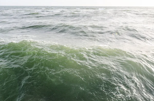
What sort of wave can shake the whole Earth for nine days straight? In September 2023, Greenland’s remote Dickson Fjord answered that question with a rare, breathtaking display of nature’s power: a mountaintop collapse unleashed a mega-tsunami so huge it reverberated through Earth’s crust in a slow, steady rhythm that baffled scientists from Alaska to Australia.
1. The Collapse That Started It All
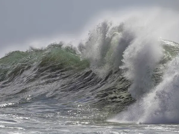
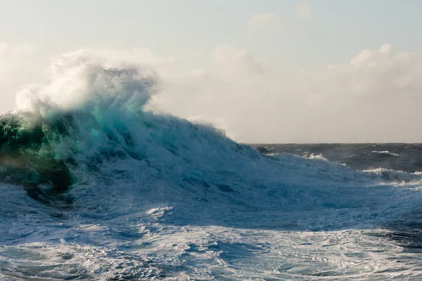
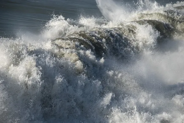
On September 16, 2023, a chunk of more than 25 million cubic meters of rock and ice-the equivalent to filling 10,000 Olympic-size swimming pools-broke loose from the 1,200-meter peak at Hvide Støvhorn. The mass plunged into the fjord, smashing its way through a glacier and possibly triggering a submarine landslide. The impact hurled up a wave approximately 650 feet high, about half the height of the Empire State Building.
2. A Fjord Perfectly Shaped for Chaos
The geometry of Dickson Fjord then magnified the disaster. The narrow, deep corridor-a groove chiseled by ice-perfectly trapped the tsunami’s energy between its parallel cliffs rising 3,000 feet. The surge barreled down the fjord and then rebounded from the headland to begin a wall-to-wall rocking motion called a seiche-the resonant sloshing of water that came to define the event.
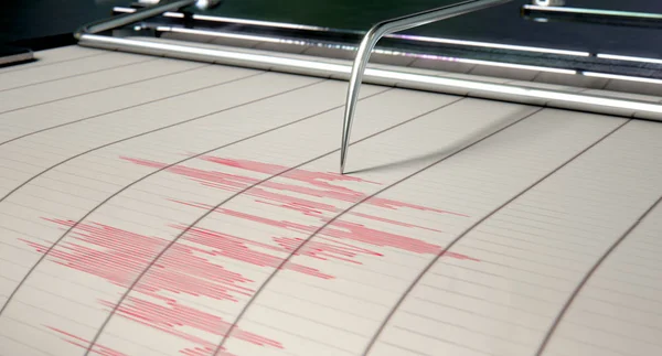
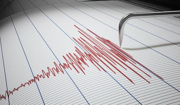
3. The Nine-Day Seismic Pulse of the Planet
Seismic stations around the world detected a monochromatic signal with peaks arriving every 92 seconds. Unlike the seismic trace of any earthquake, this one was smooth, coherent, and astoundingly persistent. Modeling revealed the fjord’s surface was rising and falling by as much as 30 feet in rhythm, pressing on the seafloor like a giant piston. “It was a big challenge to do an accurate computer simulation of such a long-lasting, sloshing tsunami,” said Alice Gabriel of UC San Diego’s Scripps Institution of Oceanography.
4. Climate Change-the Catalyst
Glacier ice once propped up the slope, but warming air and ocean waters whittled away that natural brace. “Climate change is altering what is normal on this planet, and that can trigger extraordinary events,” Gabriel said. A similar instability was blamed for the deadly 2017 Karrat Fjord tsunami, which razed eleven houses and took four lives.
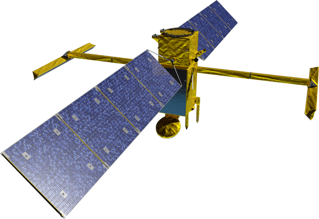
5. Satellite Breakthroughs in Event Detection
Traditional radar altimeters capture only a thin line beneath each spacecraft. SWOT, launched in December 2022, maps a 30-mile-wide swath with 8-foot resolution. SWOT’s Ka-band Radar Interferometer detected cross-channel slopes moving in opposite directions, confirming the seiche’s presence. “SWOT represents a breakthrough in our ability to study oceanic processes in areas such as fjords – places that have long posed challenges for earlier satellite technologies,” said Thomas Monahan of the University of Oxford.

6. Machine Learning Meets Ocean Physics
Professor Thomas Adcock of Oxford emphasized that to fully exploit these datasets, “We need to push the boundaries of both machine learning and our understanding of ocean physics.” Using satellite observations together with seismic data, the researchers refine models that predict how slope failures, fjord geometry, and water depth interact-a critical component for hazard forecasting.

7. The Mystery of Global Collaboration
The study attracted more than seventy researchers from forty-one institutions. “When we embarked on this scientific journey, everyone was baffled and nobody had the slightest idea what this signal was caused by,” says Kristian Svennevig of the Geological Survey of Denmark and Greenland. Field teams chronicled new scratches high on the cliffs, while supercomputers simulated the path the avalanche took and the reaction of the fjord.
8. Physics of a Confined Seiche
Numerical simulations demonstrated that the tsunami settled into a 7.4-meter-high oscillation with a period of almost but not exactly 92 seconds, equal to that of the seismic signal. The parallel shores and sharp inner bend of the fjord confined all but a fraction of the energy, limiting leakage into the outer fjord system. This geometric confinement is the reason for the seiche quality factor to rise from 500 to 3,000 as the transient decayed.

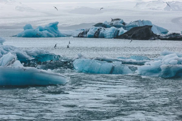
9. Implications for Arctic Safety
Dickson Fjord lies next to a popular cruise route. None were aboard on this particular date, but the risk is clear. Early-warning systems combining satellite feeds with real-time seismic monitoring are being considered by authorities; better detection could provide crucial minutes of warning for ships and settlements in high-latitude waters.
10. Shaking Up Hidden Events in Seismic Archives
Researchers now are scanning decades of seismic records for similar slow pulses. “This shows there is stuff out there that we still don’t understand and haven’t seen before,” said Carl Ebeling of Scripps. It may be possible to identify past seiches, which could reveal patterns of climate-driven slope failures that could help communities prepare for future extremes.
In the end, the Dickson Fjord mega-tsunami was more than a singular spectacle; it was a convergence of climate change, rare geology, and state-of-the-art observation. It revealed just how an enclosed Arctic fjord could create a seismic heartbeat whose pulse can be felt around the world and just how modern science can finally listen closely enough to understand it.


