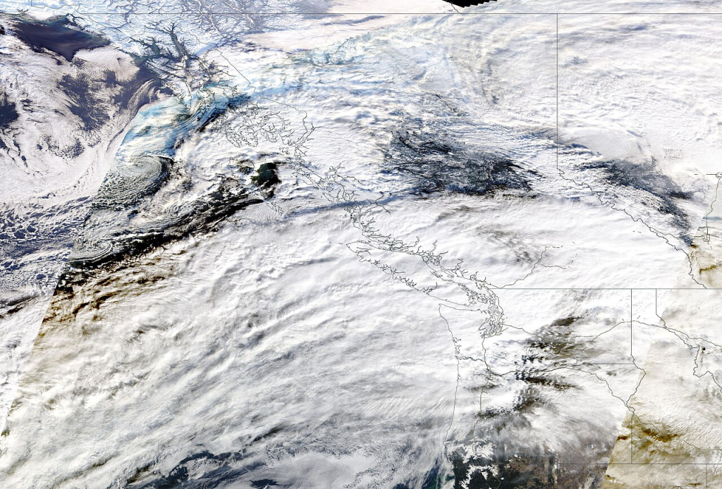
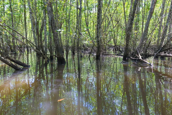
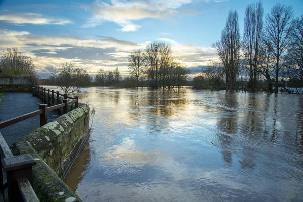
The flood that devastated the Pacific Northwest in December 2025 has emerged as the most defining climatic occurrence in the region’s history, triggered by the longest and strongest-recorded atmospheric river to hit the Puget Sound. Wind speeds associated with rainstorms engulfed the region for 20 days, resulting in inundation of the regions that stretch from southwestern British Columbia to Montana with overflowing rivers, broken levees, and washed away transport lines.
An enormous amount of up to 5 trillion gallons of rain drenched the region within a week, and snow levels were known to have risen above 7,000 feet, resulting in the resulting melting of the snow.
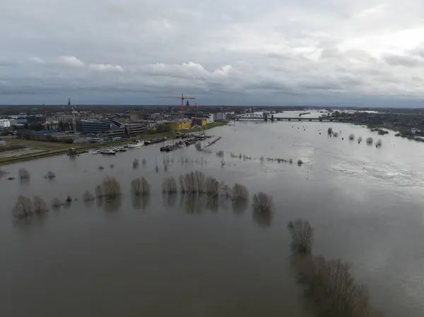
1. Scale of the Floods
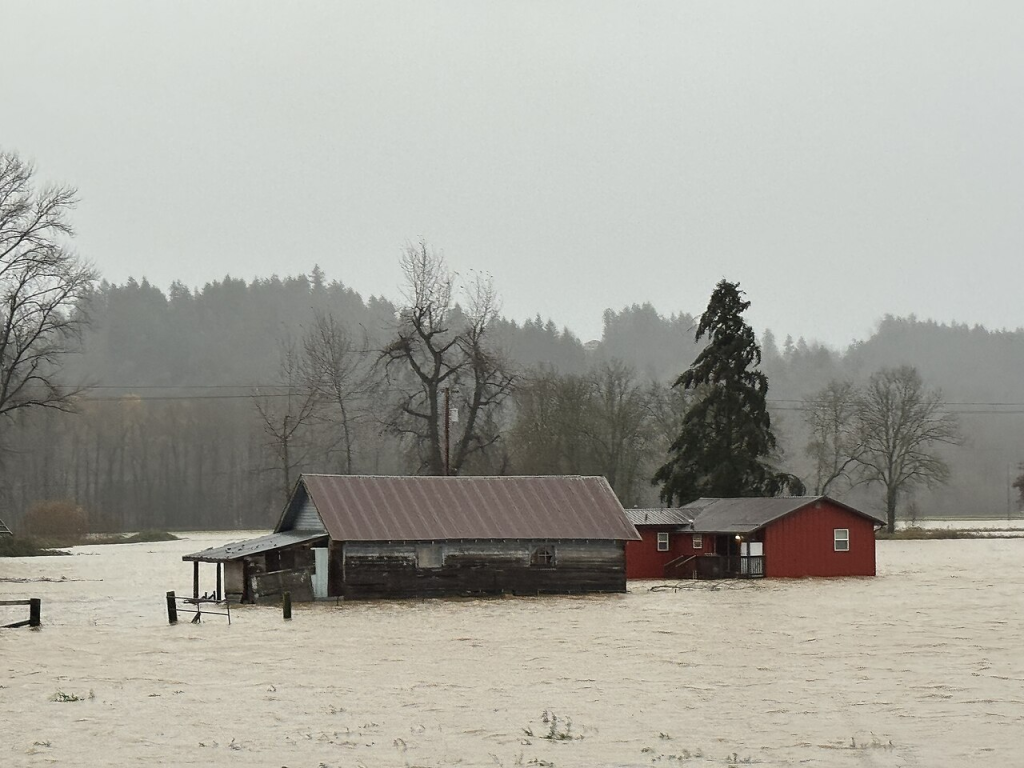
Governor Bob Ferguson declared a state of emergency on December 10, mobilizing more than 300 members of the Washington National Guard. Evacuation notices at the maximum level were issued for 100,000 residents. In the Fraser Valley area of the province of British Columbia, Abbotsford and Chilliwack showed severe flooding, with more than 370 homes evacuated within Sumas Prairie. The Snohomish, Skagit, and Cedar Rivers flooded at a record level, while the level on the Skagit River stayed at a recorded level of 42 ft near the town of Mount Vernon, evacuating the entire residents of Burlington.
2. Infrastructure Disruption
The flooding registered unprecedented levels of destruction of the transport system. All roads leading to the interior of the area from the province of Vancouver remained shut down due to flooding, rock slides, and avalanches. In the state of Washington, the U.S. Route 2 between Skykomish and Leavenworth remained under repairs for months due to flooding and remained closed to access Stevens Pass Ski Area. Additionally, closure of routes occurred on Interstate 90, U.S. Route 12, and State Route 410, making it difficult to access towns like Randle and Packwood. The transport between Seattle and Vancouver, as well as linking Amtrak, had to be cancelled, while the ferry services changed due to the flooding of the waterways due to debris.

3. The Role of Atmospheric Rivers
“Atmospheric rivers” are characterized as “narrow channels of highly concentrated vapor, and these features account for 30- to 50% precipitation in the Pacific Northwest.” These atmospheric rivers primarily affect the North America region. The 2025 December storm landed on the Category 5 level when it made landfall. For the record, this strength compares equally with other major incidents such as AR-6 from 2006 and the 1867 flood.
Climate scientists also observe that with the increase in global warming, the amount of water vapor in the atmosphere also increases. Hence, the intensity of A study begun by NASA predicts that by the end of the century, atmospheric rivers are expected to be wider and longer by as much as 25% and to have twice the occurrence rate of strong atmospheric rivers.
4. Climate Change and Future Risks
Breanna Zavadoff of the University of Puerto Rico, through affiliation with CIMAS, declares definitively, “The science is clear: warmer air can hold more water vapor, leading to more precipitation, which in turn leads to flooding.” The Pacific Northwest, with the ranges of mountains through which water falls, especially if the precipitation falls on the snow, contributes greatly to the increased level of precipitation in the region, leading to increased snow melt, thereby affecting water management in the region. Snow melt, with the arrested water vapor trails, observed in December 2025, can also soon be a reality in the region.

5. Community Preparedness & Resilience
While the scale of the disaster ensures the need for large-scale investment in infrastructure, community-level resilience is also necessary. Methods utilized in the Resilience Framework created by NRDC include establishing the neighborhood phone tree, linking a local directory for care centers, and coordinating the construction of collaborative emergency storage units. Social safety networks are sometimes necessary within the community during the occurrence of a disaster or tragedy and can be strengthened via anchor institutions.
6. Nature-Based Solutions
Moreover, green infrastructure like trees, wetlands, and bioswales can assist in reducing flood-related damages by the floodwater absorption and cooling effect that these have on an urban environment. Also, riparian restoration and preservation of an existing canopy of old trees can aid in reducing runoff and enhancing the health of the nervous system. Areas that suffer from floodwaters can benefit from the removal of storm drains and the implementation of permeable sidewalks to drain excess rainfall.

7. Energy Resilience in Adverse Weather
Conditions Power outages have affected over 400,000 customers who were affected by the floodings. The states that have largely been affected are the state of Washington and Oregon. For those who rely on powered medical devices and the storage of medicines within the refrigerator, power outages created health hazards. Solar lighting solutions, batteries, and charging stations are very important in scenarios where power outages occur. Micro-grids, solar community plans, and resilience hubs that include power back-up systems are approaches that should be employed.
8. Policy & Infrastructural Investment
Municipalities have a great importance to be included in making the region more resilient. This is due to zoning, structural, & local plans. Creating awareness for the importance for hazard mitigation plans, enhanced Storm Water, & plans on the topic of Climate Change would ensure that the target beneficiaries, in this case, the deprived, & the vulnerable sections, would be included in the spending plans. Forecast Informed Reservoir Operations would be the example of how the forecast of the weather would increase the safety of the dam to be protected from the flood threat.
Floodwaters in December 2025 have left millions, & the recovery efforts would be for several months or even for years. But the reality of the current event would be hard to miss, & the reality is, the answer is before the storm, & this is how the Pacific Northwest would prepare for the challenge & the threat that would come with the regular Atlantic Rivers.


