How fast winter can go from serene to chaos, right? Across the north eastern United States, this is no longer a matter of if but where, and how fast, this developing low barreling from the Midwest to the Northeast, determined to unleash heavy snow, strong winds, and an arctic blast pushing back against any warming trends.

1. A Cyclone’s Expansive Reach
As per the National Weather Service, “This mid-latitude low system” is impacting Montana to Maine, Texas to Pennsylvania. The system includes snow, a blizzard, freezing rain, and thunderstorms. Over 8 million people are being impacted due to winter weather advisories, while close to 2 million people are at risk due to the potential for a blizzard. It is likely that “the system would reach its peak Monday morning before it races into southeastern Canada.”
2. Blizzard & Lake Effect Hazards
Over a foot of snow is forecast from the upper Great Lakes, where strong winds produce whiteout conditions and heavy drifts. Lake-effect snow, strong bands of heavy snowfall from cold air blowing over relatively warm surface waters, will continue through the Snow Belt and Lower Great Lakes through the early morning on Wednesday. Lake-effect snow is forecast to continue at least through the middle of the week in the Buffalo, New York, area, while visibility will be reduced to near zero from snow squalls impacting Pittsburgh.
3. Arctic Front Ends Record Warmth
The Arctic cold front that is accompanying the low pressure system has led to temperatures dropping as much as 30-40 degrees in the central parts of the US. Although the temperatures in Dallas reached highs of 80s, the night temperatures dipped into the 40s. St. Louis has received a massive drop of 63 degrees with -12 Real Feel. The I-95 corridor is seeing a drop of as much as 20-30 degrees in a day. The wind chill is even lower.

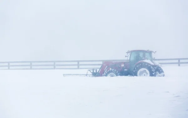
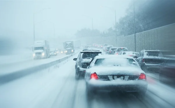
4. Travel Disruptions and Power Threats
There are growing closures on the roads with the NWS reporting that the conditions on the roads in Marquette, Mich., are extremely difficult to impossible. There are gusts of up to 60 mph that are blowing down trees and power lines. There are over 100,000 power outages that have occurred in Missouri, Kentucky, and Illinois with ice accumulations of up to three-fourths of an inch.
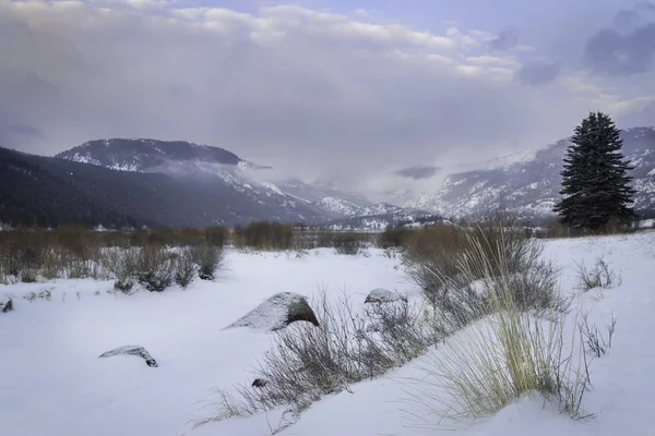
5. Lake-Effect Snow Research
The impact of lake effect snow is created by cold air moving over an open body of water and facilitating the buildup of water vapor and warmth, eventually turning to heavy snow. One region that stands to be affected by such weather conditions is the region surrounding the Great Lakes, intended to receive a large amount of snow of up to 48-60 inches in a period of a few days resulting from combined snow amounts. There may be a change in the direction of the winds in other regions.

6. Houses in Readiness for Excessive Cold
They are advised to provide protective covering for bare pipes, close any drafts, and examine their heating systems. In an interview with the US CPS, it is noted that the improper placement of generators in a power outage may result in the intake of carbon monoxide. Generators should be placed outdoors, a minimum of 20 feet away from any door, windows, but not in the garage.
7. Vehicle Readiness for Winter Storms
Drivers should equip vehicles with blankets, non-perishable food, water, a flashlight, and a shovel. Tire chains or snow-rated tires improve traction in icy conditions. Keeping fuel tanks at least half full prevents fuel line freeze-ups, and checking battery health is critical in sub-zero temperatures.
8. Community Res Mayor of Marquette
Paul Schloegel praised the local DPW and MDOT employees as true professionals, as they work to repair the roads 24 hours a day after the storms. Mayor Schloegel understood the appreciation of residents of the city and its climate created by Lake Superior and also their readiness to be prepared to “hunker down as needed.” Cooperation of the residents in other areas, like Midwestern and Northeastern areas, by being prepared to check on each other, remains indispensable to cope with the harsh situations of winter.
This cyclone, which is moving to the eastern part of the country, would be confronted with this combination of blizzard conditions, lake-effect snow, and an air mass as cold as Central Park in this range from the Midwest to the Eastern Seaboard. To prepare to survive this critical winter storm, it is vital to be aware of developments and minimize exposure during peak times to ensure heating and power remain operational.


