
“A great Cascadia earthquake is not a single event of shaking; it is a chain reaction that can redraw shorelines, divide neighborhoods, and stretch healthcare and transportation systems to the limit in minutes. In the Pacific Northwest, the danger is a familiar one in broad outline and a chilling one in detail: violent shaking offshore, sudden land level change onshore, and tsunami waves that will arrive before many people can process what is happening.”
What has brought about a change in preparedness from a theoretical concept to a practical one is the realization of the clues that scientists and planners are constantly pointing to the patterns in the geologic record, the vulnerable spots in the built environment that models have identified, and the limited time frames that determine who can get to safety.
1. A subduction fault long enough to link three states
The Cascadia Subduction Zone extends for some 600 to 700 miles from Northern California to British Columbia, which is sufficient to allow earthquakes to become “exceptionally large.” In scenario planning, a complete margin rupture is linked to “magnitude 9-class” shaking that lasts for minutes rather than seconds. This is important because the longer shaking duration raises the probability of structural failure, slope failure, and cascading lifeline outages power, water, roads, and communications systems all failing simultaneously rather than sequentially.
2. The coastal record shows repeated “great earthquakes,” not a one-time anomaly
Evidence in coastal sediment and buried soils shows that Cascadia has had many large earthquakes and tsunamis in the thousands of years. There have been 17 large earthquakes in the past 6.7 thousand years, based on Bayesian modeling of 554 radiocarbon dates. The point for people is not a countdown; it is that the region has a history of severe events, including earthquakes that may be of different lengths some of them closer to 8, some of them closer to 9 shaking which parts of the coast and the land routes will take the biggest hit.
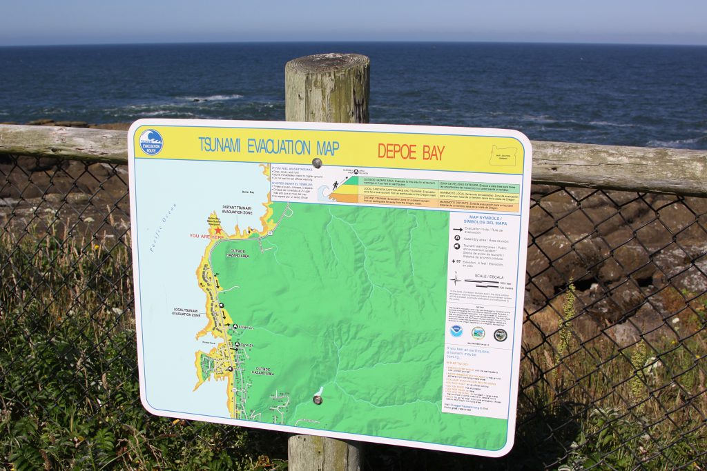
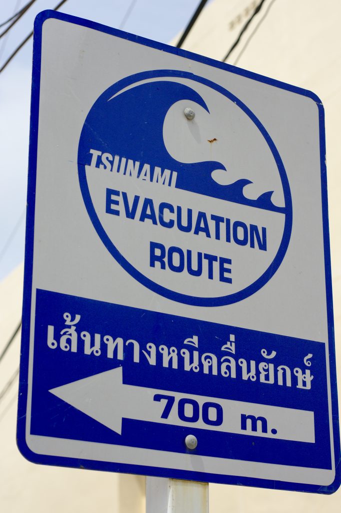
3. Shaking time and tsunami time are measured in minutes
For major subduction earthquakes, strong shaking can continue for four to six minutes, and tsunami waves may reach the coast in 15 to 20 minutes. This leaves a very short time frame for decision-making, where evacuation becomes less about driving and more about getting to higher ground as quickly as possible. In many areas, the limiting factor is not awareness but route capacity how many people can get out in time without congestion.
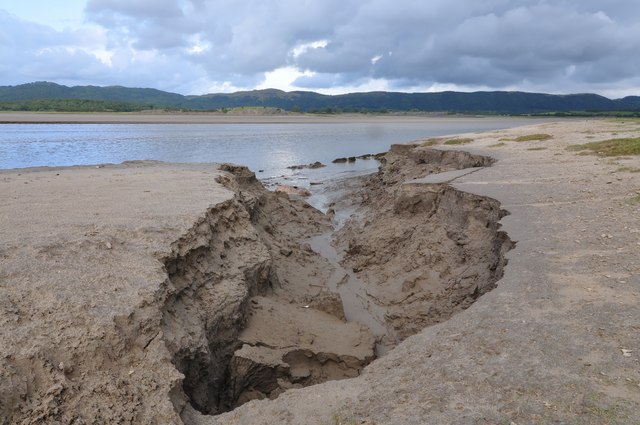
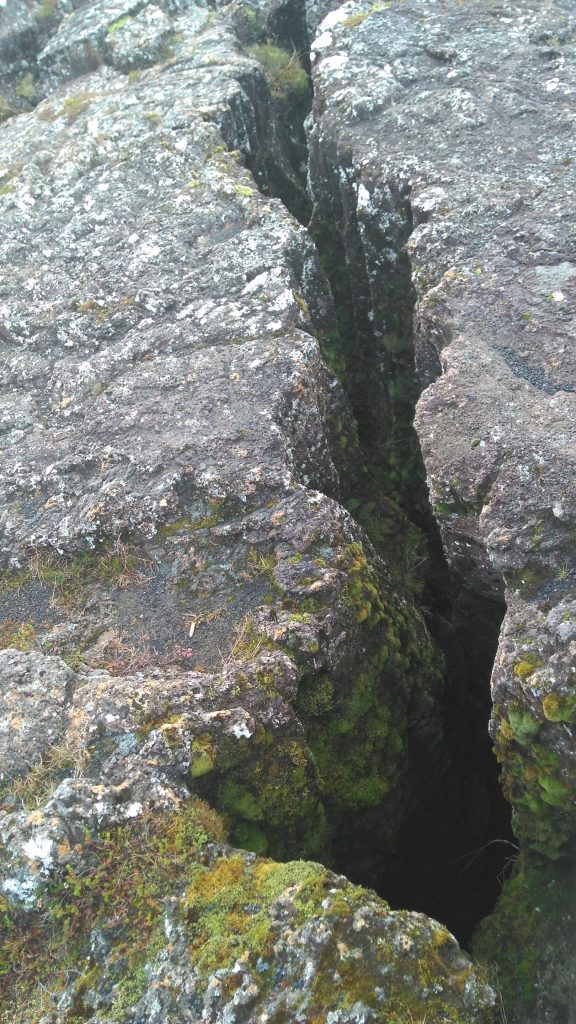
4. The ground itself can drop, permanently, before the first wave arrives
One of the most characteristic hazards of Cascadia is coastal subsidence, which results from the land sinking as the fault unloads. A study published in the Proceedings of the National Academy of Sciences predicted that the coastline could sink as much as 6.5 feet, which would increase the federally defined 1% annual chance floodplain by 35 to 116 square miles. What this means is that some areas would be flooded not only by the tsunami but by the newly lowered shoreline.
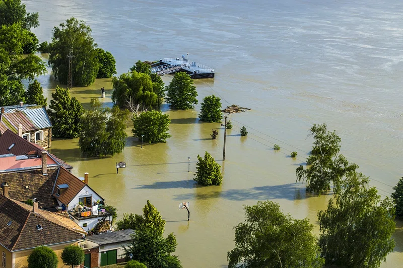
5. Flood exposure can double “after the quake,” not just during it
The same study projected that an earthquake occurring beneath today’s sea level could put an additional 14,350 community members, 22,500 buildings, and 777 miles of roads within the floodplain after the earthquake. Essential facilities are included in this number, such as airports, schools, hospitals, wastewater treatment plants, and contaminant sources, which could impede earthquake recovery efforts due to flooding and accessibility issues.
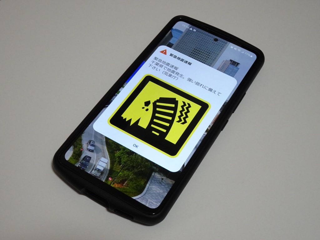
6. Early warning exists, but it delivers seconds not safety by itself
The ShakeAlert system on the West Coast can send an earthquake alert to phones and other systems by detecting an earthquake and calculating the expected shaking. The system is intended to give seconds of warning before the shaking becomes damaging, sufficient for taking protective measures such as “drop, cover, and hold on,” or automatic measures such as slowing down trains and closing valves. In nearby earthquakes, the warning time may be less than 10 seconds, and in close-in areas, shaking may precede an alert.
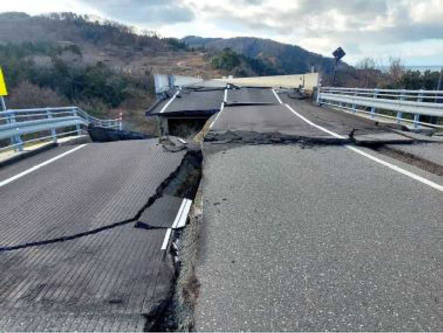
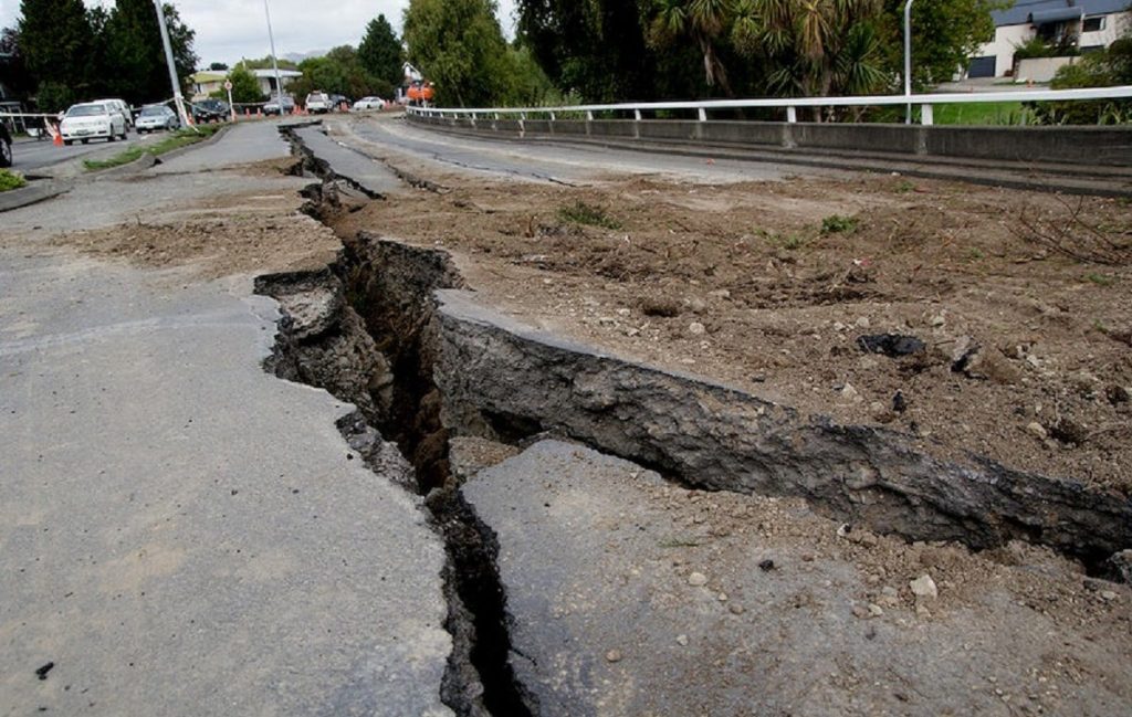
7. Downtown lifelines can fail at the exact moment they are needed most
Major earthquakes make transportation a medical problem: if bridges and routes are out, trauma care, dialysis, oxygen delivery, and assisted living evacuations will all be more difficult to accomplish. In Portland, Multnomah County has outlined the grim status quo: none of downtown’s Willamette River vehicular bridges will be functional after a major earthquake, which is why the Earthquake Ready Burnside Bridge project is a lifeline route for emergency access. The bigger clue is regional: it takes a few bridges, ramps, and routes to function in the worst-case scenario.
8. Coastal healthcare is being redesigned around vertical evacuation and continuity
Some facilities are treating the tsunami risk as a design constraint, rather than an add-on to an emergency plan. Columbia Memorial Hospital’s expansion on the Oregon north coast incorporates a tsunami vertical evacuation shelter into a critical access hospital, with major building systems and service lines located in high areas so that the hospital can remain in operation even if lower levels are affected. For the local community, this represents a design that reflects the shift in the preparedness mindset, from buildings that provide healthcare infrastructure to buildings that provide both healthcare infrastructure and a shelter in the event that roads and communications fail.
9. Preparedness gaps widen when mitigation funding and projects stall
So many life-saving upgrades seismic retrofits, evacuation routes, school safeguards require long lead times and a steady flow of capital. The end of FEMA’s Building Resilient Infrastructure and Communities (BRIC) program and the halt of pending applications will interrupt this flow. For communities living in tsunami and liquefaction risk areas, the answer is in the structure: preparedness is more than individual preparedness it is whether public infrastructure can be hardened before the next long shaking day. The warning signs of Cascadia are never blockbuster material; they are encoded in recurrence histories, flood zones, bridge models, and the few seconds of warning that an alert can provide. Taken together, they suggest a reality of preparedness that is a function of time minutes to evacuate on the coast, seconds to safeguard the body on the mainland, and years to harden the infrastructure that people depend on when all else fails.


