When people look for the “safest” place in a nuclear crisis, the maps tell a more limited story. They do not show true safety. They show relative fallout risk in certain attack scenarios, especially models centered on strikes against U.S. missile silos.
That distinction matters. Researchers and preparedness experts have long stressed that immediate radiation exposure is only one part of the picture, while shelter, infrastructure failure, food systems, and long-term environmental disruption would shape survival far beyond the first few days.

1. Maine
Maine appears repeatedly in lower-exposure zones because it sits far from the central belt of missile silos that dominate many strike simulations. In fallout mapping built around those silo targets, distance works in its favor, and so do typical wind patterns that more often carry radioactive material eastward from the interior rather than back toward the far Northeast.
That does not remove risk. It means Maine is often shown receiving a lighter dose in the first four days after a silo-focused attack than states closer to likely military targets.

2. New Hampshire
New Hampshire is often grouped with northern New England in scenarios where fallout concentrates over the Great Plains and Upper Midwest. In those models, expected exposure tends to stay below the levels seen in states surrounding major missile fields.
The practical takeaway is modest but important: a state can be lower risk on a fallout map and still face serious disruption if transportation, communications, and medical systems break down nationally.

3. Vermont
Vermont’s lower population density and distance from the central missile corridor help explain why it often lands on the less-affected side of these maps. It is not usually treated as a primary target in silo-centered modeling, and that shifts its short-term outlook compared with states in the interior West and Plains.
Radiation models are only one lens. Public health guidance on nuclear incidents continues to emphasize shelter in place for as long as one month in some conditions, which shows how much depends on what happens after the initial blasts.

4. Massachusetts
Massachusetts benefits in many simulations from being well east of the missile fields that would likely draw early strikes in a counterforce attack. Some maps place much of coastal New England in relatively lower fallout ranges during the opening days.
Still, urban density changes the broader equation. Lower fallout does not guarantee easier access to supplies, medical care, or evacuation routes if a national emergency spreads far beyond the original targets.

5. Rhode Island
Rhode Island is small, coastal, and distant from the silo states that dominate immediate-target models. That combination often places it in a zone with lighter short-term fallout than much of the Midwest.
Its inclusion says more about geography than resilience. A state with lower modeled radiation can still be highly vulnerable to shortages, port disruption, and cascading failures in energy and public services.

6. Connecticut
Connecticut often appears alongside its New England neighbors in lower-dose scenarios tied to missile-silo attacks. The underlying logic is straightforward: the farther a place is from high-priority launch sites, the better its odds of avoiding the heaviest plume in the earliest phase.
One reason these maps gained attention is the fallout reaching everything from Texas to Maine in some simulations, even when the most severe exposure remains concentrated elsewhere.

7. Washington
Washington stands out because West Coast states are often less exposed in silo-focused fallout models. Typical west-to-east air flow can reduce the amount of radioactive material reaching the Pacific coast from targets in the interior.
That pattern helps explain why some analyses place parts of the West Coast near 0.001 Gy in average scenarios, a level much lower than the lethal threshold of 8 Gy often cited in radiation discussions.
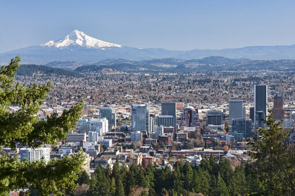
8. Oregon
Oregon tends to follow the same pattern as Washington in these simulations. Its coastal position and distance from the densest cluster of missile silos keep it out of the worst immediate fallout paths in many model runs.
A longer view complicates that advantage. Educational simulations such as Princeton’s Plan A have illustrated how quickly a limited exchange can escalate into infrastructure collapse on a much wider scale.

9. California
California is often described as less affected in silo-based fallout mapping, especially compared with the northern Plains and Rocky Mountain states. The Pacific coast can act as a geographic buffer in those narrow scenarios, reducing early exposure from strikes on inland missile facilities.
But California also shows the limits of any “safe state” label. Other targeting assumptions, especially those involving major cities, naval assets, or infrastructure hubs, can change the picture dramatically. The historian Alex Wellerstein has noted that NUKEMAP is intended as an educational resource, not a tool for emergency response planning.
The larger pattern across these states is clear: lower modeled fallout usually follows distance from missile silos, coastal geography, and prevailing winds. That is useful context for understanding risk, but it is not a promise of protection. In every scenario discussed by researchers, the hardest truth remains the same. Nowhere is truly safe in a full nuclear exchange, and the maps are best read as a guide to relative exposure in the first days, not a guarantee of long-term survival.


