
Hurricane risk in the United States is not spread evenly. Long-track Atlantic and Gulf storms repeatedly threaten some coastlines, while other metros sit outside the most common pathways used in historical landfall maps, insurance models, and federal risk tools.
That does not make any city hazard-proof. It does mean some places are regularly viewed as lower-risk options when the focus is specifically on hurricanes, especially those located inland, north of the busiest landfall zones, or along coasts that geography tends to shield.

1. Pittsburgh, Pennsylvania
Pittsburgh is often highlighted in broader disaster-risk comparisons because much of the metro shows up as lower risk in FEMA-based mapping. For hurricane-focused thinking, its advantage is straightforward: it is well inland and far from the Atlantic and Gulf coastlines that absorb direct landfalls most often.
That positioning matters because more than 300 U.S. hurricane landfalls have been recorded since 1851, with the highest concentration along Florida, Texas, Louisiana, and the Southeast coast. Pittsburgh can still feel remnants through rain or wind, but it is rarely treated as a primary hurricane-exposure metro in national risk conversations.

2. Syracuse, New York
Syracuse appears frequently in low-disaster discussions for one main hurricane reason: distance from warm coastal waters. Located deep inland, it is removed from the storm-surge and direct landfall threats that define the highest-risk zones.
Its trade-off is winter weather, not tropical cyclones. In hurricane models, that distinction tends to matter because the city does not sit near the coastal corridors where storms retain their strongest structure.

3. Dayton, Ohio
Dayton is another inland metro often treated as comparatively safer from hurricanes than cities closer to the Atlantic seaboard or Gulf Coast. Its location in southwestern Ohio places it well away from direct coastal strike zones.
Federal risk tools look at multiple hazards at once, but hurricane-specific logic still favors cities like Dayton. By the time tropical systems travel that far inland, they have usually weakened substantially, even when rain bands remain disruptive.

4. Minneapolis, Minnesota
Minneapolis is rarely part of the national hurricane conversation, and that is exactly why it shows up as a safer option in major models. It is distant from the oceans that sustain tropical cyclones and outside the regions known for recurring landfalls.
The scientific explanation is rooted in storm fuel. Hurricanes depend on ocean water warmer than about 80 degrees F., and Minneapolis is far beyond that coastal energy source. Other weather threats remain part of life there, but hurricane exposure is generally low.

5. Charlotte, North Carolina
Charlotte stands out because it sits in a hurricane-prone state without carrying the same level of direct coastal exposure as places closer to the Outer Banks. That difference often helps it perform better than North Carolina’s shoreline communities in broader risk comparisons.
It is not isolated from tropical weather. Rain, wind, and inland flooding can still affect the metro when coastal storms move inland. But compared with front-line beach and barrier-island locations, Charlotte is often rated as the less exposed urban option.

6. Allentown, Pennsylvania
Allentown benefits from the same broad regional pattern that gives parts of the Mid-Atlantic and interior Northeast a relative hurricane buffer. It is inland, north of the most active southern strike zones, and not positioned like the most vulnerable coastal bends.
A useful backdrop comes from historical mapping that shows very few direct hurricane landfalls in the mid-Atlantic around Washington, D.C. because coastline orientation and steering patterns often send storms elsewhere. Allentown is not on the coast at all, which adds another layer of separation.
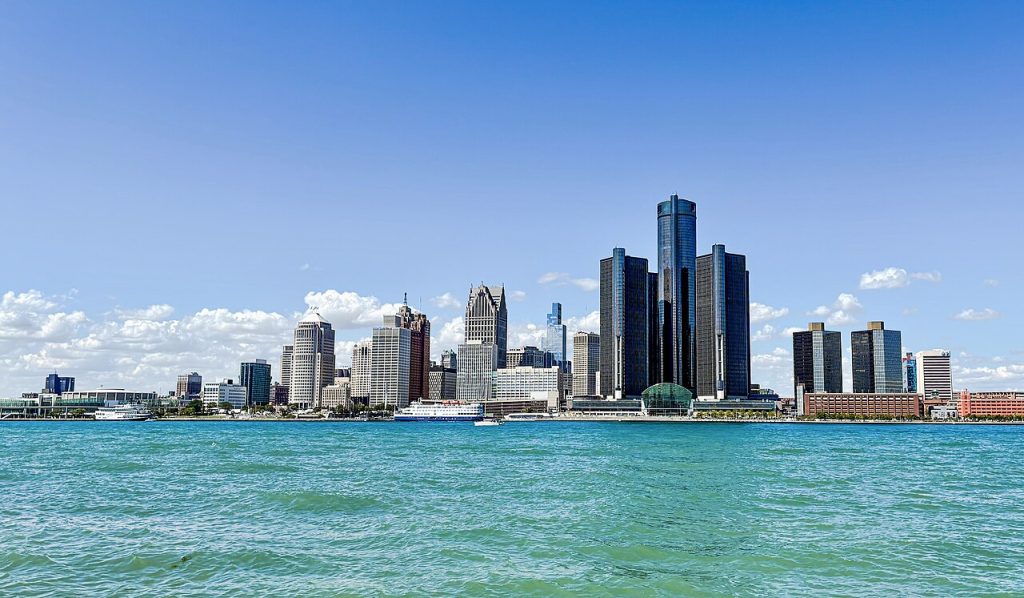
7. Detroit, Michigan
Detroit is far removed from the Atlantic hurricane belt, making it a regular candidate in lists about lower overall natural-disaster risk. For hurricane models, the city’s inland Great Lakes position is the main advantage.
That does not erase severe weather risk from other sources, but it sharply reduces the chance of facing direct tropical landfall. In practical terms, Detroit is usually assessed through a very different hazard lens than Miami, Houston, or New Orleans.

8. Irvine, California
Irvine enters the conversation from a different angle. It is not hurricane-safe because it is inland from the Atlantic; it is safer because the U.S. West Coast almost never receives true hurricane strikes. Scientific explanations point to both storm tracks and sea temperatures.
In the Northeast Pacific, storms generally move away from the U.S. coast, and cooler waters near California sap their strength. As NOAA-linked hurricane science explains, the West Coast’s cooler ocean temperatures do not sustain hurricanes. That leaves Southern California with other hazard concerns, but usually not full-strength hurricanes.

No city has zero risk. FEMA’s National Risk Index and private-sector models are designed to compare exposure, expected loss, social vulnerability, and resilience across places, not to promise complete safety.
Still, when hurricane risk is the lens, a clear pattern emerges. Inland metros, northern cities, and a few geographically protected regions are often rated more favorably than the nation’s most exposed Atlantic and Gulf coastline communities.


