The Cascadia Subduction Zone does not need headlines to remain one of North America’s defining natural threats. Running offshore from Northern California to British Columbia, this fault system has shaped coastlines, forests, and oral histories for centuries, and researchers continue to refine what a future rupture could mean for the Pacific Northwest. What has changed is the detail. New mapping, offshore monitoring, lake sediment records, and tsunami modeling have sharpened the picture: the danger is not limited to shaking alone. It includes land that can suddenly sink, flood zones that can expand in minutes, infrastructure that may fail in chains, and communities that may need to rely on themselves long after the first wave passes.
1. The fault is vast, but it may not behave as one single break
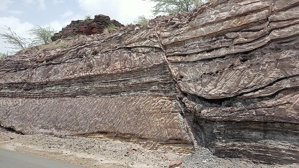
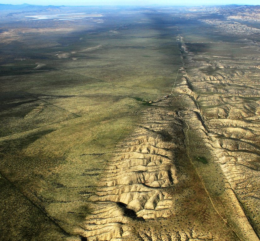
Cascadia stretches roughly 600 to 700 miles along the Pacific margin, and researchers no longer treat it as a simple, uniform crack. A newer subsurface map suggests at least four distinct segments with different rock structures and rupture behavior. That matters because earthquake size and shaking patterns depend on how much of the margin breaks at once. Some sections appear rougher and more likely to interrupt rupture, while one smoother Washington segment may allow stronger propagation and extend hazard farther inland. Harold Tobin said, “It requires a lot more study, but for places like Tacoma and Seattle, it could mean the difference between alarming and catastrophic.”
2. Cascadia’s unusual quiet may be hiding a more complicated system
Unlike many active subduction zones, Cascadia has long puzzled scientists by being relatively silent. That silence helped build the idea that the plates were fully locked and steadily storing strain for one future release. Offshore monitoring has complicated that picture. A 2026 University of Washington study found the northern section appears locked and compacting, while the central section showed signs of a shallow slow-slip event and pulses of fluid moving through underground pathways. Marine Denolle said, “It’s preliminary, but we think that variable fluid pathways in Cascadia will change the behavior of large earthquakes on the fault.” The finding does not erase the threat, but it does show that the fault’s behavior is less uniform than older public narratives suggested.
3. The timeline is uncertain, but the long record is hard to ignore
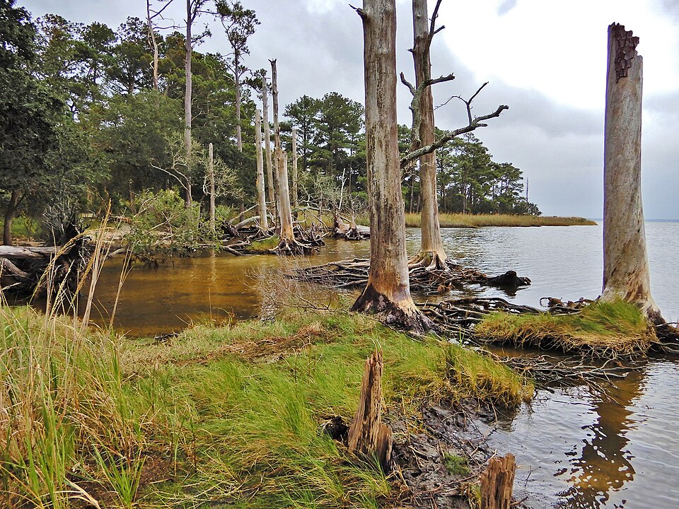
The most recent great Cascadia earthquake struck on January 26, 1700, a date supported by ghost forests, Japanese records of an orphan tsunami, and Indigenous oral traditions. Researchers have identified many more ancient earthquakes through wetlands, offshore turbidites, drowned forests, and lake sediments. One recent USGS lake study found Ozette Lake preserves 30 to 34 distinct event deposits over 14,000 years. For the last 5,500 years, at least 10 were likely megathrust earthquakes, with recurrence intervals measured in centuries, not millennia. That record helps explain why scientists continue to frame Cascadia as a persistent hazard rather than a remote possibility.
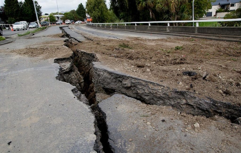
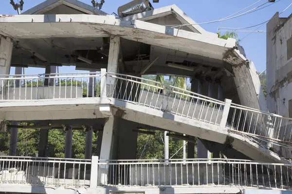
4. The first disaster may be shaking, but the second is the ground itself
A major Cascadia rupture is expected to produce violent shaking that can last for more than a minute and, in some scenarios, much longer. Yet one of the most consequential effects may happen when the shaking stops: parts of the coast can drop permanently. Recent research on coastal subsidence indicates some areas could sink by about 6 feet or more almost immediately. Tina Dura described the regional timing bluntly: “Geologically speaking, we’re well within the window of possibility.” Unlike gradual sea-level rise, this kind of land loss is abrupt. Roads, neighborhoods, wetlands, and utility corridors can be left at lower elevations in a single event, altering how water moves across the landscape for decades.
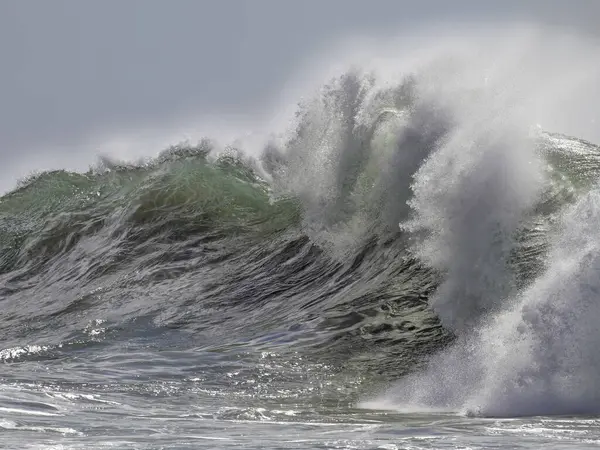
5. The tsunami threat is not just one wave and not just one hour
Cascadia’s tsunami risk remains severe even as scientists refine the details. Some coastal stretches may face waves approaching 90 to 100 feet, and in many places evacuation time would still be measured in minutes. What recent work adds is nuance, not reassurance. New offshore imaging suggests a continuous megasplay fault may not exist along the entire margin, which means tsunami arrival and height may vary more by coastline than earlier plans assumed. But water danger does not end with the first surge. Diego Melgar said, “you get this massive surge that lasts for hours, sometimes days,” and in subsided areas some seawater may not drain away at all.
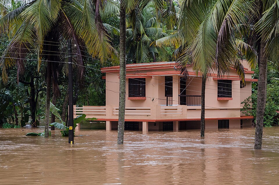
6. Flood maps after the quake may look nothing like the ones before it
This is where earthquake science and climate science now intersect. If the land drops and sea level is already higher, the post-quake coastline can become permanently more flood-prone. Researchers have warned that earthquake-driven subsidence could greatly enlarge floodplains and expose far more buildings, roads, and critical facilities to chronic water damage. Hospitals, wastewater systems, ports, and agricultural land are part of this picture. Some communities may face not only immediate disaster, but a long afterlife of nuisance flooding, saltwater intrusion, and lost buildable land.
7. A Cascadia rupture may not stay a Cascadia problem
The Pacific margin is a connected tectonic neighborhood. One newer sediment-core study from near Cape Mendocino suggests a large Cascadia earthquake may, in some past cases, have been followed very quickly by major movement on the northern San Andreas system. Chris Goldfinger said, “A lightbulb went on and we realized that the Noyo channel was probably recording Cascadia earthquakes, and that at a similar distance, Cascadia sites were probably recording San Andreas earthquakes.” The timing remains under study, but some core evidence points to linked events within minutes or hours. That raises the regional stakes well beyond one fault trace.
8. Seattle’s risk is not limited to the offshore megathrust
For inland cities, Cascadia often dominates the public imagination. But shallow crustal faults nearer population centers can produce a different kind of danger. Research using ancient trees in the Seattle fault zone points to a linked-fault earthquake between 923 and 924 C.E. that may have reached about magnitude 7.8. Because these faults sit much closer to the surface and run beneath densely populated areas, they can deliver concentrated urban shaking and even local tsunami effects. As Brian Sherrod put it, “We kind of know what might happen during a Cascadia Subduction Zone event. But the big unknown is these crustal faults.”
9. Preparedness still depends on ordinary systems working fast
Even the best science does not become protection unless people receive warnings and know what to do. ShakeAlert is publicly available in California, Oregon, and Washington, delivering earthquake early warnings through wireless alerts, Android systems, and the MyShake app. Its role is limited but important. ShakeAlert is not prediction, and people closest to the source may get little or no warning. But seconds can still matter for “Drop, Cover, and Hold On,” slowing trains, stopping elevators, and triggering protective actions at hospitals and utilities.
Local planning matters just as much: evacuation routes, neighborhood response teams, resilience hubs, and infrastructure retrofits are the practical layer between scientific insight and survival. The sharper the science becomes, the clearer the pattern looks. Cascadia is not one hazard but a stack of them: shaking, sinking ground, tsunami surge, long-term flooding, infrastructure isolation, and uneven local vulnerability. For the Pacific Northwest, the most useful warning sign may be this one: researchers are no longer arguing about whether Cascadia belongs on the region’s list of defining risks. They are refining how many ways it can reshape life when it does move.


