The Pacific Northwest lives beside one of the planet’s quietest and most powerful faults. Far offshore, the Cascadia Subduction Zone stores strain where the Juan de Fuca Plate presses beneath North America, creating the conditions for a rare kind of earthquake that can change coastlines in minutes.
For residents of Oregon, Washington, northern California, and coastal British Columbia, the concern is not only shaking. Scientists now describe Cascadia as a chain reaction hazard: ground failure, tsunami flooding, permanent land loss, broken transport links, and long recovery windows that would reshape daily life well beyond the shoreline.
1. Cascadia is long enough to produce a truly giant earthquake
The fault stretches about 700 miles, running from Northern California to British Columbia. It is a megathrust boundary, the same class of fault capable of producing the world’s largest earthquakes, and researchers have long said Cascadia can generate a magnitude 9.0 or larger event. Regional earthquake education materials describe a 1,000 km long plate boundary where the plates are locked by friction in the shallow zone, allowing strain to build over time. That combination of length and stored energy is what makes Cascadia different from more familiar inland earthquakes.
2. The region has done this before, and the last full event was in 1700
Cascadia is not a theoretical threat drawn from computer models alone. Geological records, coastal land changes, and tsunami evidence across the Pacific all point to a major rupture on January 26, 1700, with an estimated magnitude between 8.7 and 9.2. That history matters because it places the modern Pacific Northwest inside a known recurrence pattern. Scientists cite intervals that vary widely, but many records place great Cascadia earthquakes on the scale of centuries rather than millennia. Native oral histories and Japanese tsunami records remain central to how the event was confirmed.
3. The odds are serious even though no one can name a date
Researchers cannot predict the exact year of the next rupture, but they have published meaningful probability ranges. Current estimates commonly place the chance of a full-margin magnitude 9 event in the next 50 years at around 10% to 15%, while larger counts that include lower-magnitude major earthquakes raise the regional risk further. The Oregon Department of Emergency Management says there is about a 37% chance of a magnitude 7.1 or greater earthquake in this fault zone over the next 50 years. That distinction is important: not every damaging Cascadia earthquake would be the absolute worst-case rupture, but the basin-wide threat remains substantial.
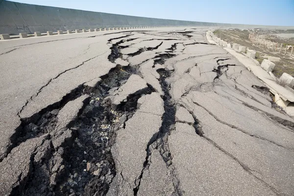
4. Shaking could last for minutes, not seconds
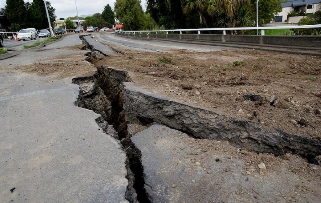
In many earthquakes, destructive shaking is brief. Cascadia is different. Emergency planners and state guidance have warned that coastal areas could experience five to seven minutes of violent motion, with weaker but still serious shaking extending inland. That duration changes everything inside homes, hospitals, schools, bridges, and water systems. Long shaking increases the chance of structural failure, landslides, broken pipelines, and the loss of basic footing during evacuation. It also means the first emergency is not the only one.
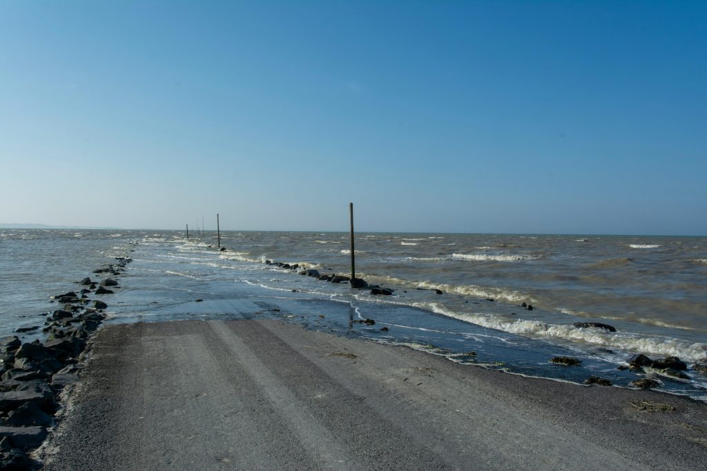
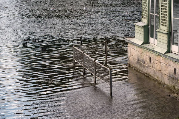
5. The coastline could drop permanently within minutes
One of the most unsettling findings in recent research is that some low-lying land may not simply flood and drain. It may sink. Studies highlighted in 2025 projected that parts of the coast could fall by as much as six feet, instantly expanding flood zones and leaving some places below sea level. That prospect turns a tsunami into something more enduring than a surge. Researchers warned that some coastal areas may suddenly sink, making permanent inundation possible in the same places that have just been struck by waves. For communities built around estuaries, bays, and river mouths, the recovery map could look very different from the pre-quake one.
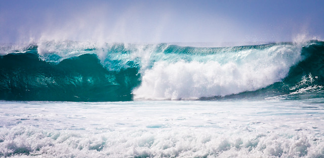
6. The tsunami risk is immediate, but not identical everywhere
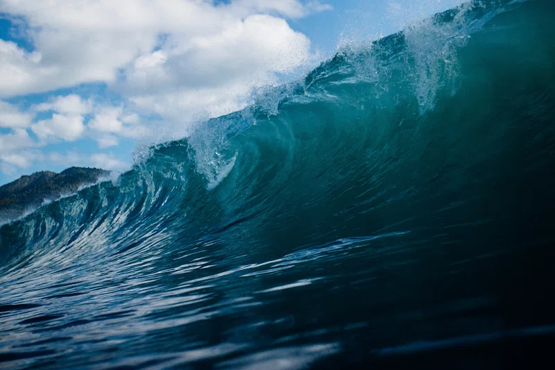
Cascadia can send tsunami waves toward shore fast enough to leave coastal residents with very little margin. Wave heights in some scenarios reach 90 to 100 feet, and near-field tsunami danger begins almost as soon as the ground stops moving. At the same time, newer offshore mapping has added nuance. Research discussed by Oregon Public Broadcasting found no evidence for one continuous megasplay fault along the entire subduction zone, suggesting tsunami size and arrival timing may vary more by location than earlier planning assumed. That does not reduce the need to evacuate; it sharpens the need for place-specific maps and route planning.
7. Small earthquakes do not “release the pressure”
Cascadia’s quietness often misleads people. Frequent small earthquakes elsewhere on the West Coast do not meaningfully empty the energy stored on this fault, and researchers have repeatedly said even a magnitude 8 earthquake would not equal the full release possible in a locked megathrust system. This is partly because earthquake magnitude is logarithmic. A step upward in magnitude represents a much larger jump in energy, not a modest one. Cascadia can remain outwardly subdued while still accumulating the conditions for an extreme rupture.

8. New offshore data suggests the fault is more complex than once believed
Recent monitoring has shown that Cascadia may not behave as one uniformly locked slab. A 2026 University of Washington study found the northern part appears more locked, while the central section showed signs of slow-motion slip and fluid movement that may affect how a rupture travels. Researchers examining 13 years of ground motion data said these differences could influence earthquake propagation and severity, even if they do not change the overall odds of a major event. The practical takeaway is not reassurance. It is that Cascadia remains under-observed, and better offshore instruments are still needed.
9. Recovery could take weeks for basics and years for infrastructure
The human toll often gets described in fatalities and dollar losses, but the slower crisis is isolation. Earlier planning scenarios estimated more than 13,000 deaths in a full Cascadia disaster, alongside widespread bridge damage, port disruption, broken utilities, and communities cut off from aid. State preparedness guidance has warned that residents may be without services or assistance for at least two weeks. That is why Cascadia planning focuses so heavily on evacuation routes, seismic retrofits, community hubs, and local readiness for medically vulnerable populations.
In a megathrust disaster, survival depends not only on escaping the first wave of destruction, but also on enduring the long silence that follows. Cascadia remains one of North America’s clearest examples of a low-frequency, high-consequence threat. The science has grown more detailed in recent years, especially around permanent flooding, offshore fault behavior, and the uneven shape of tsunami risk. The broad message has not changed. The Pacific Northwest faces a hazard capable of altering land, infrastructure, and daily life on a regional scale, and every new study has made that reality more specific rather than less.


