The Pacific Northwest lives beside one of the planet’s most powerful fault systems, and much of its danger comes from how quietly it waits. Offshore, the Cascadia Subduction Zone has spent centuries storing strain where the Juan de Fuca plate presses beneath North America.
Scientists do not describe the threat as remote. They describe it as inevitable on a geologic timescale, with consequences that extend far beyond shaking alone: collapsing infrastructure, sudden coastal flooding, isolation, and a tsunami that can arrive before many people have time to think clearly.
1. The fault can produce one of Earth’s largest earthquakes
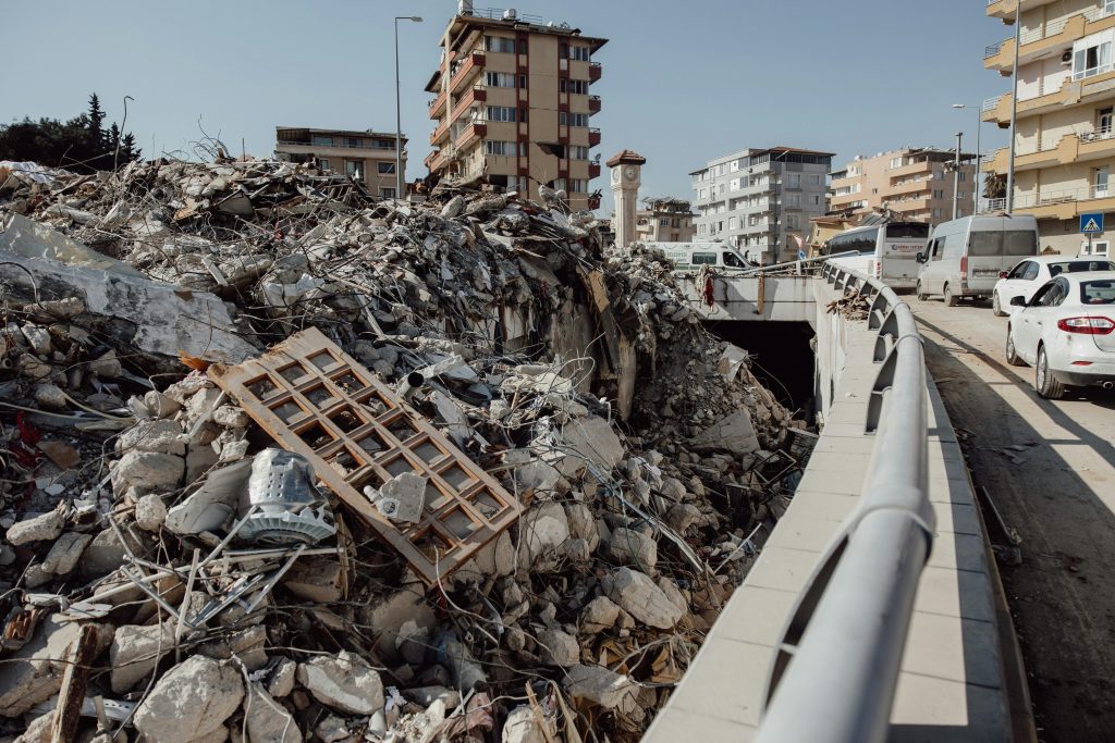
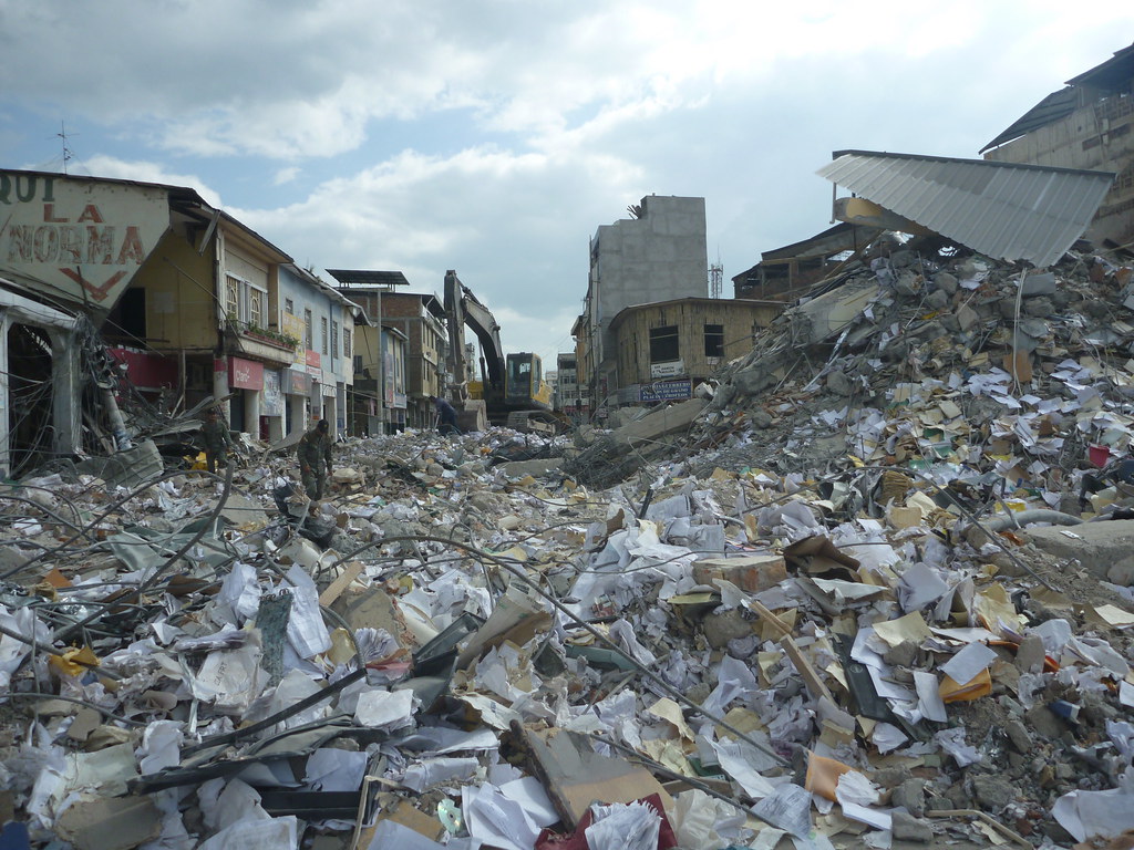
The Cascadia Subduction Zone runs roughly 700 miles along the Pacific Northwest margin, from northern California to British Columbia. It is a megathrust fault, the type capable of generating the world’s biggest earthquakes, and researchers say a 10-15% chance of a full-margin ~M9 earthquake in the next 50 years remains the benchmark estimate. That scale matters because a full rupture would not behave like a brief jolt. It could shake for minutes, affect multiple states at once, and trigger widespread damage in inland cities as well as on the coast.
2. The region has already experienced this kind of disaster
Cascadia’s last known megathrust earthquake struck on January 26, 1700. Its size was reconstructed from coastal geology, drowned forests, Indigenous oral histories, and the famous orphan tsunami in Japan, which arrived without any locally felt quake there.
That history gives the threat a human scale. Villages were flooded, settlements were abandoned, and the event remained legible for centuries in tree rings, sediment layers, and stories passed through Native communities from Vancouver Island to northern California.
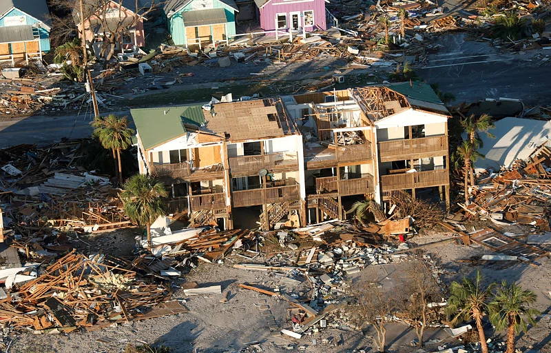
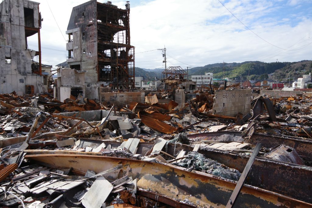
3. A future death toll could be measured in the thousands
Planning scenarios for a major Cascadia rupture have long pointed to mass casualties. The main drivers are not only collapsed buildings, but also tsunami exposure, landslides, damaged hospitals, blocked roads, and the difficulty of moving vulnerable residents out quickly.
Emergency officials have warned that winter conditions would make the picture worse because saturated ground can amplify shaking and slope failures. People in assisted living, nursing homes, or on dialysis stand out in preparedness planning because they may need rapid evacuation under conditions when transport systems are already failing.
4. The coastline may drop in minutes and stay that way
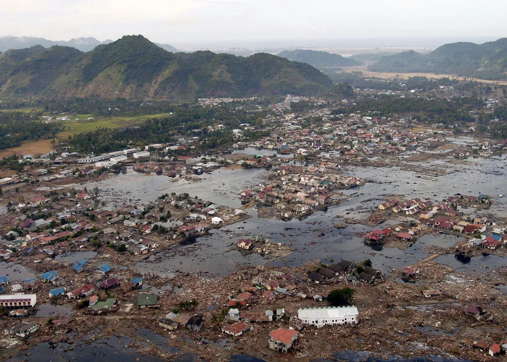
One of the least intuitive dangers is permanent subsidence. In parts of the coast, land can sink several feet during the quake itself, turning today’s dry ground into tomorrow’s chronic flood zone.
Researchers studying Cascadia’s coastal response have found the floodplain footprint could be altered for centuries. That means the disaster would not end when the shaking stops. Roads, neighborhoods, habitat, and public facilities in low-lying areas could face a long afterlife of repeated inundation.
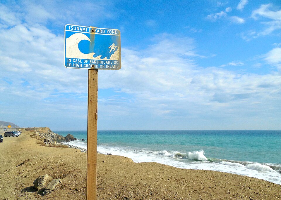
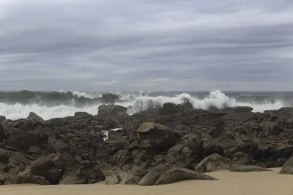
5. Tsunami escape windows could be brutally short
Along the outer coast, the tsunami hazard is immediate. Models cited across preparedness planning show waves that may reach extraordinary heights in some locations, while many communities would have only minutes to move uphill on foot.
That short timeline changes what preparedness means. For coastal residents and visitors, survival depends less on waiting for detailed instructions and more on recognizing the earthquake itself as the warning: if the ground shakes hard and long, the move to higher ground starts at once.
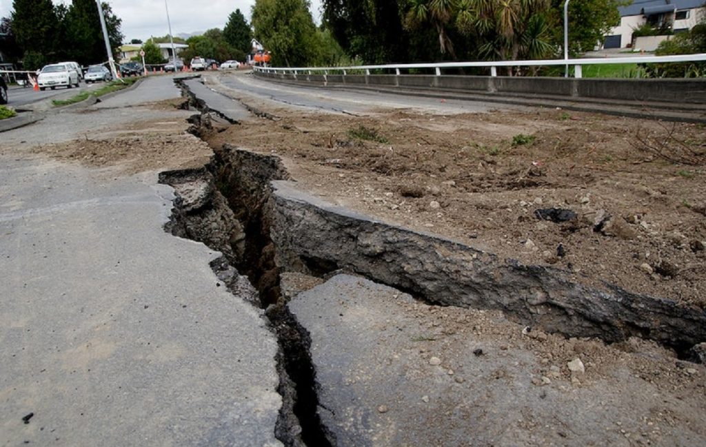
6. Inland cities are not outside the damage zone
The popular image of Cascadia risk often centers on beach towns, but major inland cities would face severe shaking, broken utilities, and transportation failures. In the Puget Sound, geology adds another layer of danger because sedimentary basins can trap and amplify seismic waves.
Simulation work has shown that some urban areas farther from the fault could still shake intensely because of local ground conditions. Damage would depend not only on distance from the coast, but also on soil, basin structure, and the vulnerability of older buildings and bridges.
7. New seafloor research shows the fault is not equally locked everywhere
Cascadia is no longer seen as a single uniform seam. Offshore monitoring and imaging have revealed a more segmented system, with evidence of variable locking, slow slip, fluid movement, and structural tears in the descending plate.
A 2026 study reported signs that the central region appears to be more active than the northern section, while separate imaging has identified plate tears and microplate boundaries offshore of Oregon and British Columbia. Researchers have said these features may influence how a rupture spreads, though they do not erase the core hazard or change the need for preparation.
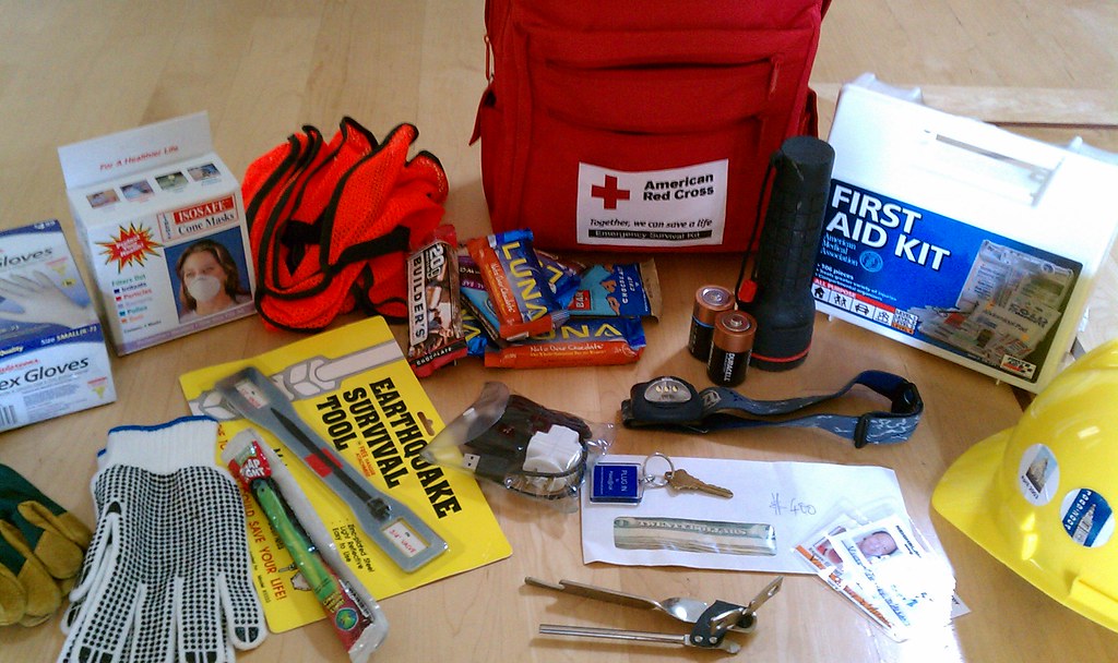
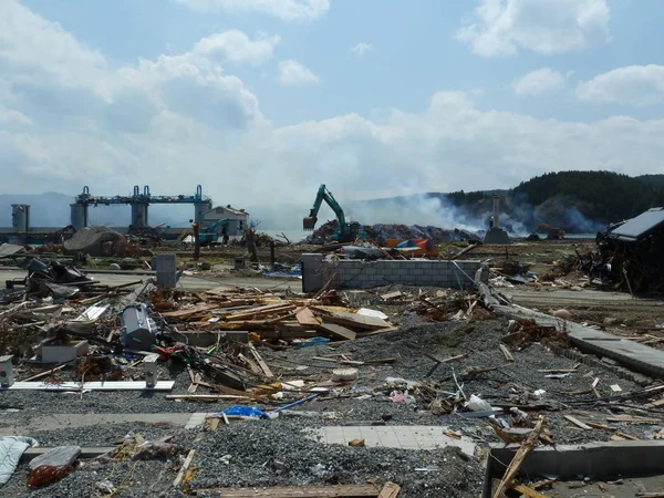
8. Communities may be largely on their own at first
After a full Cascadia rupture, outside help is not expected to arrive instantly. County emergency managers have repeatedly warned that many residents may need to function without dependable roads, power, water, wastewater service, or cell networks for at least two weeks.
That is why current planning places so much weight on neighborhood level readiness. Communication plans, stored water, food, first aid supplies, and knowing who nearby has medical training or mobility limitations can shape the first days more than any distant response operation.
9. Preparation still lags behind the scale of the threat
The region has made visible progress, but not evenly. Some counties are expanding evacuation mapping, resilience hubs, bridge retrofits, and local response networks, while rural communities still face steep gaps in funding and infrastructure.
Officials have described the work as a race against time. The Burnside Bridge replacement in Portland, local hazard team models in Washington, and coastal vertical evacuation efforts show what preparation looks like when it moves from awareness to construction. Yet many schools, hospitals, and older buildings remain exposed, especially where retrofits are expensive and grant support is uncertain.
The clearest lesson from Cascadia is that the earthquake is only part of the story. The lasting risks come from what follows: water where land used to be, roads that no longer connect, and communities forced to rely on plans made long before the ground starts moving.
That is why the threat continues to command scientific attention. Each new clue from seafloor sensors, historical records, and community drills sharpens the same conclusion: survival in Cascadia depends on understanding the landscape before it changes.

