“A magnitude 9 earthquake on the Cascadia Subduction Zone is usually talked about in terms of shaking and wave height, but the underlying public health narrative is one of time, terrain, and what works after the shaking stops.” In Oregon, Washington, and Northern California, the threat is not one event. It is a quick sequence: minutes of violent motion, sudden sinking of the coast, and then fast water.
The planning process usually looks at these as separate issues, but in fact, they are all part of one big problem that families, hospitals, and emergency officials face. The following are realities that have evidence backing them, and they define what preparedness is in an area where the coastline itself can change.
1. Cascadia is large enough to fail in ways that will overwhelm “local” planning
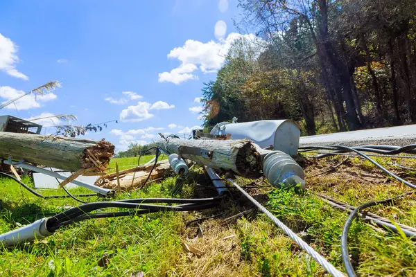
The Cascadia Subduction Zone extends about 700 miles from Northern California to British Columbia, providing a set of circumstances where multiple states are threatened with severe damage at the same time. The total-margin rupture is projected to be about magnitude 9, with shaking that can continue for several minutes, long enough to destroy transportation, communication, and water infrastructure before tsunami evacuation can even start. Geological history shows a pattern of great earthquakes over thousands of years, including the last major event in 1700.
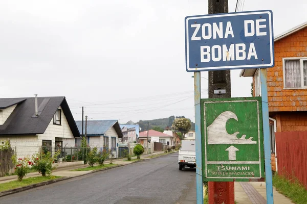
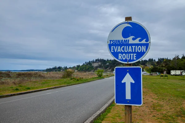
2. The life-or-death window on the coast is measured in minutes, not hours
For many coastal communities, the real warning is the shaking itself. In commonly used scenarios, the arrival of the tsunami can follow as quickly as 15 to 20 minutes, packing the decisions into a sprint that includes injuries, debris, and broken roads. This time frame shortens further for those with limited mobility, those in care facilities, and those beginning from low ground near bays, river mouths, or marinas.
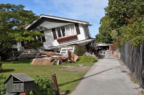
3. The land along the coast can fall by more than six feetinstantly
One of the least intuitive risks is the earthquake-induced subsidence, where the coastline can sink several feet in an instant. Research at Virginia Tech, published in the Proceedings of the National Academy of Sciences, found that this sinking can increase the 1% annual chance floodplain by tens to more than a hundred square miles. This is not a temporary puddling effect but rather changes the flood risk every day, drainage patterns, and recovery efforts into a long-term relocation process.
4. Exposure to flooding can be more than doubled even if the tsunami is not the only problem
The same model indicates that following the large earthquake “today” might be at risk 14,350 more people, 22,500 buildings, and 777 miles of roadways within the floodplain, in addition to airports, schools, hospitals, wastewater treatment plants, and contaminant sites. This is important for health because “response” becomes a health system issue: dialysis, oxygen, refrigeration for medications, sanitation, and shelter all require infrastructure that could be under water.
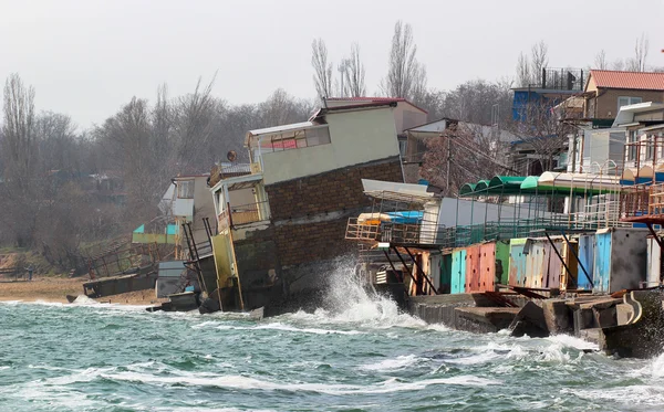
5. Rising seas make subsidence a permanent habit of flooding
Subsidence is a permanent process on the human timescale, and a rising background sea level increases subsidence. The Virginia Tech study cites that the degree of localized relative sea-level rise could be as much as three feet by the year 2100, increasing the number of people and property at risk from the next major earthquake. This creates a compound hazard, where the earthquake produces new low-lying areas, and the higher seas keep them flooded.
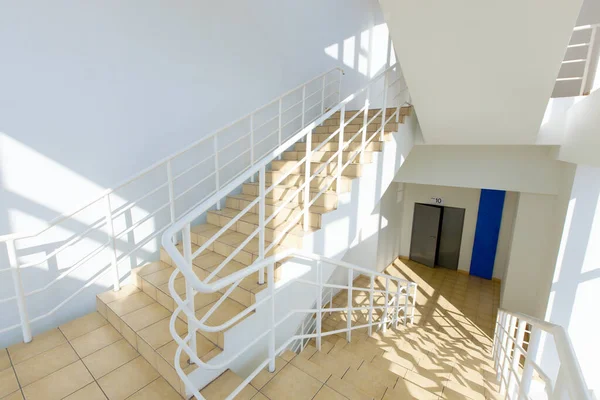
6. Vertical evacuation is becoming a central survival tool where “running” fails
In the flat areas, the engineered high ground may be the only accessible location to evacuate to. The Gladys Valley Marine Studies Building at Oregon State University’s Hatfield Marine Science Center is a vertical evacuation facility with necessary resources on the roof to sustain 920 people for two days. The building has several ways of accessing the roof, including a ramp, stairs, and an emergency elevator that has power backup, since not all evacuees can ascend quickly, and not all routes will remain open.
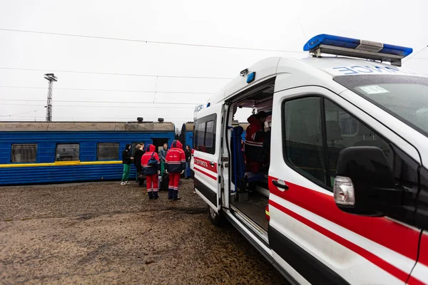
7. Coastal hospitals are threatened in two phases: liquefaction, followed by flooding
Coastal healthcare is particularly at risk because it is the population that is most in need of care that is least likely to be able to evacuate. In Astoria, Columbia Memorial Hospital has been working on a large seismic upgrade and vertical refuge design because it was determined that the hospital was not ready for a Cascadia earthquake. Its CEO, Erik Thorsen, was very matter-of-fact about the ground conditions at his hospital: “that ground underneath us would liquefy and the building would potentially collapse.” Even if it does not, he said, “maybe we get 20 to 30 minutes of notice to evacuate people up the hill.”
8. Seconds of warning can still prevent injuriesif alerts are enabled and understood
Earthquake early warning systems do not predict earthquakes, but they can sense when an earthquake has started and alert people before the stronger shaking arrives. The ShakeAlert earthquake early warning system, which is operated by the USGS, can offer seconds for protective actions such as Drop, Cover, and Hold On, and it can also initiate automated protective measures for some infrastructure. In the Cascadia scenario, these seconds can help prevent traumatic injuries that later flood hospitals that are already struggling with access, power, and staff.
9. Preparedness is ever more dependent on the unglamorous infrastructure that keeps society running
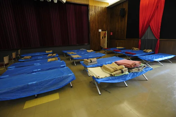
“Estimates of losses and numbers of deaths may receive the most public attention, but recovery may depend on whether bridges, ports, generators, wastewater treatment plants, and shelter facilities remain in operation.” Some cities are engaged in resilience projects like hospital power backup and microgrids, while others are working on evacuation routes and upgrades. The connecting factor is continuity. In a large-scale disaster, health requires access to clean water, adequate heat, basic medical care, and available shelter well before relief can be brought in.
Cascadia planning becomes more plausible when it considers the earthquake, subsidence, and tsunami as one rapid sequence. The specifics that appear to be technical how high the roof of a refuge is, whether an elevator is powered by emergency power, whether warnings are turned on directly correlate to who can move, who can breathe, and who can be treated. In the Pacific Northwest, “survival is often a matter not of whether the hazard exists, but of whether the next ten minutes have somewhere safe to end.”

