The Pacific Northwest’s most dangerous fault does not announce itself with constant drama. The Cascadia Subduction Zone is unusually quiet, which is part of what makes it so unsettling to researchers studying how giant earthquakes build, unfold, and reshape coastlines in minutes. What has changed is not the existence of the risk, but the detail of the picture. New mapping, offshore monitoring, climate-linked flood modeling, and renewed study of the last great rupture are giving scientists a sharper sense of what warning patterns matter most and why the region’s real danger extends far beyond shaking alone.
1. Silent slow-slip events beneath Cascadia
Some of the most closely watched seismic activity in Cascadia is not felt at all. Researchers track slow slip events, a kind of deep fault movement that unfolds gradually rather than as a jolt. These episodes are often paired with tremor and recur on different schedules depending on location, including roughly every 14 months in northern Washington and about every 22 months in central Oregon. Scientists do not treat every slow-slip event as a direct alarm, but some view them as one of the most important possible precursors to major subduction-zone earthquakes. As Washington state seismologist Harold Tobin put it, deciding when such clues are meaningful is “Exactly what might keep me up at night.”
2. Offshore strain changes that suggest the fault is not behaving uniformly
Cascadia is no longer being described as a single, equally locked structure from end to end. A 2026 University of Washington study found the northern portion of the fault is locked and quiet, while parts of the central region appear more active. Researchers also detected signs of a shallow slow-motion earthquake and pulses of fluid moving through underground pathways. That matters because fluids can influence how rupture spreads during a major event. Co-author Marine Denolle said, “It’s preliminary, but we think that variable fluid pathways in Cascadia will change the behavior of large earthquakes on the fault.”
3. A fault broken into segments rather than one simple line
Detailed mapping has made Cascadia look less like a single zipper and more like a chain of linked sections. Scientists working on recent offshore surveys found the fault can be divided into multiple segments, each with the capacity to produce a very large earthquake on its own. That does not eliminate the possibility of a full-margin rupture. It does, however, change how researchers think about spreading failure, tsunami generation, and the range of possible outcomes. A segmented fault can produce different combinations of damage depending on where rupture begins and whether it jumps between sections.
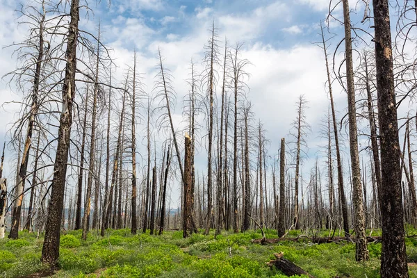
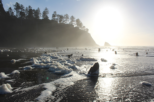
4. The ghost forests that still mark the last great rupture
Dead cedar forests along Washington’s coast remain one of the clearest records of Cascadia’s last giant earthquake in 1700. Tree-ring studies and Japanese records of an “orphan tsunami” helped pin that event to a specific winter night, making it one of the best reconstructed prehistoric disasters in North America. Those drowned forests are more than a historical curiosity. They show that coastal land dropped suddenly, saltwater flooded in, and whole landscapes changed almost instantly. The physical evidence supports what modern models now warn: the next great Cascadia event would not just shake the ground, it would redraw the shoreline.
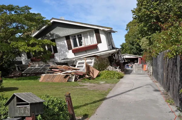
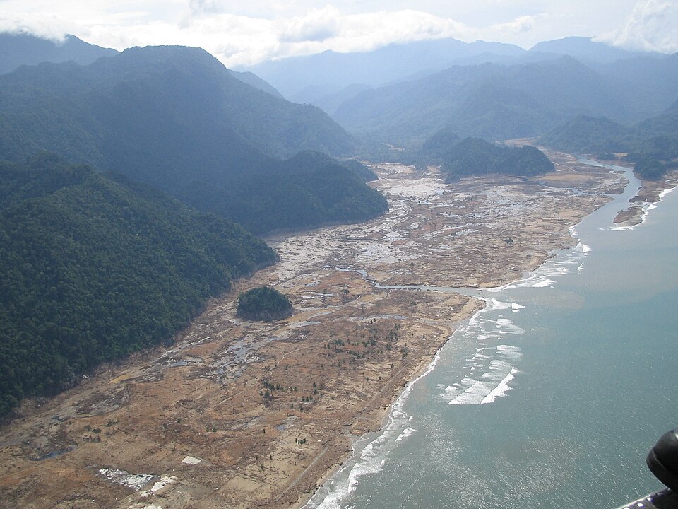
5. Evidence that the coast could sink within minutes
One of the grimmest findings in recent research is how much permanent land loss could follow the quake itself. A USGS-backed study found a magnitude 8 or greater Cascadia event could cause 1.6 to 6.6 feet of sudden land subsidence along parts of the coast. That means some neighborhoods would be lower before the tsunami even finishes arriving. Floodplains could expand immediately, and places now considered marginally safe could become chronically inundated. Tina Dura described the broader implication clearly: “The loss of intertidal wetlands directly affects ecosystem services such as water filtration, habitat for fisheries and shorebirds, and carbon storage capacity.”
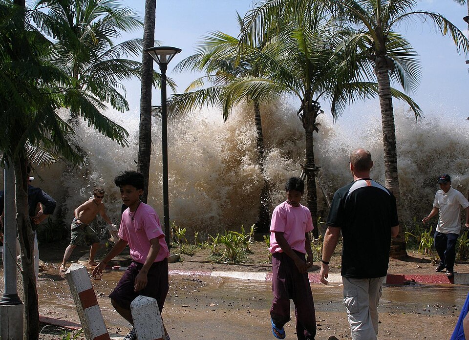
6. Tsunami modeling that now includes long-lasting flooding, not just one wave
The old image of a tsunami as one devastating surge and retreat is proving too simple for Cascadia. Newer models emphasize that water may remain in some areas because land dropped below sea level during the quake. This is why some researchers describe the aftermath as a flooding crisis that does not end when the wave passes. Diego Melgar framed the sequence bluntly: “Then there would probably be 30 to 40 minutes of seeming peace. But that’s a false impression, because the tsunami is coming.” In parts of the region, the real legacy would be transformed coastlines and persistent inundation.
7. Revised tsunami assumptions in places without a continuous megasplay fault
Not every new finding makes the scenario worse in exactly the same way. Research highlighted in 2025 suggested Cascadia may not have one continuous megasplay fault running the full margin, which could mean some coastal areas face smaller or slightly slower-arriving tsunamis than older assumptions projected. That is not a signal of safety. It is a sign that the hazard is becoming more geographically specific. Emergency planning improves when it is based on better fault geometry rather than blanket assumptions for the entire coast.
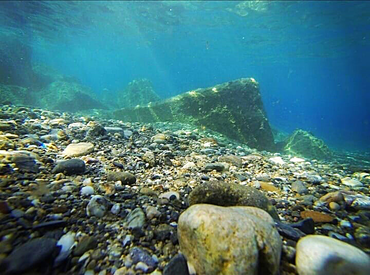
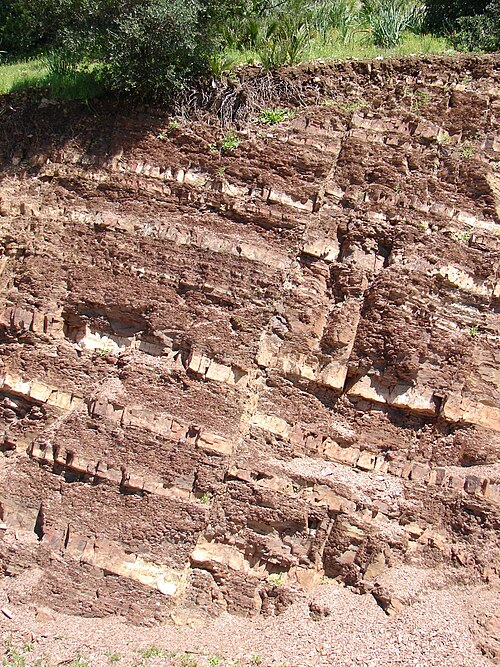
8. A growing archive of ancient underwater landslides
Scientists are also reading Cascadia’s history from the seafloor. MBARI and USGS researchers used advanced underwater vehicles and sediment sampling to identify a continuous, event-by-event record of Cascadia’s great earthquakes preserved in offshore deposits. That record helps confirm how often major ruptures have occurred and strengthens confidence in long-term hazard estimates. It also expands the story beyond tree rings and coastal marshes, showing that earthquake-triggered submarine landslides can preserve an offshore memory of repeated megathrust events over deep time.

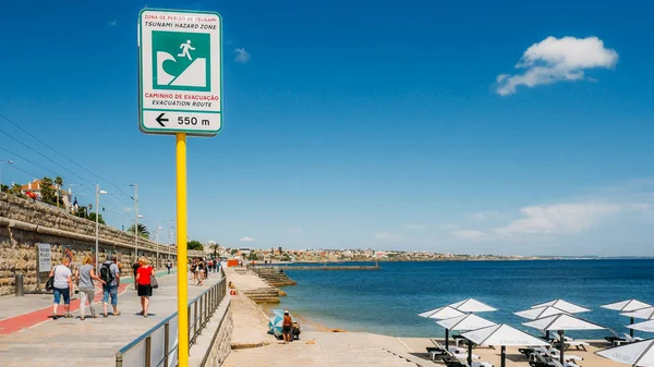
9. Preparedness gaps that make every scientific clue more consequential
The science is becoming more precise, but readiness remains uneven. Some communities still lack adequate evacuation routes, resilient bridges, or hardened hospitals, and emergency planners continue to warn that many residents would need to be self-sufficient for up to two weeks after a major event. That is why even subtle warning patterns matter. Better detection does not automatically translate into a clear public alert, especially when elevated risk may still be statistically small. Tobin captured that dilemma in one sentence: “You don’t want a mass evacuation panic that’s not warranted, but you want people not to go on their merry ways.”
The emerging red flags around Cascadia are not dramatic in the usual sense. They are shifts in strain, buried sediment layers, drowned forests, fluid pulses, and quiet movements deep beneath the coast. Together, they reveal a hazard that is becoming easier to study and harder to simplify. For the Pacific Northwest, the clearest message is that the next great earthquake is no longer defined only by shaking. It is increasingly understood as a chain reaction of land loss, flooding, isolation, and infrastructure failure that begins offshore and reaches far inland.

