The Pacific Northwest lives beside one of Earth’s quietest giant hazards. Far offshore, the Cascadia Subduction Zone runs for roughly 700 miles from Northern California to Vancouver Island, storing strain where one tectonic plate dives beneath another.
What makes Cascadia so gripping is not only the size of the threat, but the way science has assembled its history from drowned forests, offshore sediments, Indigenous oral traditions, and Japanese tsunami records. Together, they describe a region where the landscape itself can change in minutes.
1. Cascadia is capable of the kind of earthquake that reshapes coastlines
The fault is not an ordinary crack in the ground. It is a megathrust, the class of fault that produces the world’s largest earthquakes, and scientists have identified Cascadia as capable of a full-margin event near magnitude 9.0 or higher. According to the Pacific Northwest Seismic Network, subduction zone megathrust faults are the only faults on Earth that can produce earthquakes greater than M8.5. In practical terms, that means shaking could continue for several minutes rather than a few seconds. It also means the event would not stay local. Roads, ports, power systems, hospitals, and coastal communities across multiple states could be affected at once.
2. The last great rupture was confirmed by waves recorded in Japan
Cascadia’s most famous clue came from across the Pacific. Scientists tied the region’s last great earthquake to an “orphan tsunami” in Japan, where destructive waves arrived without any locally felt quake. That puzzle matched evidence on the North American coast: drowned “ghost forests,” tsunami sands, and long-preserved oral histories describing violent nighttime shaking and flooding. The result is one of the clearest reconstructions of a premodern earthquake anywhere in the world, dating the last great Cascadia rupture to January 26, 1700, with an estimated magnitude between 8.7 and 9.2.
3. The 50-year odds are serious, but they are not all the same
The broad public conversation often treats Cascadia as a single all-or-nothing threat, yet the hazard is more layered than that. The U.S. Geological Survey estimates about a 10 to 15 percent chance of a full-margin M9 earthquake in the next 50 years. Southern Cascadia carries an even higher chance of a major M8+ rupture when partial-margin earthquakes are included. The same federal assessment also notes that deep intraslab earthquakes beneath Puget Sound are more likely on shorter timescales, showing that residents are dealing with several earthquake threats at once, not just the headline-grabbing megaquake scenario.
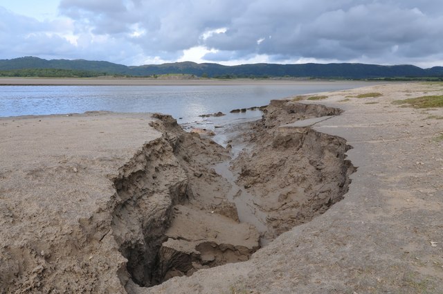
4. The coastline could drop almost instantly
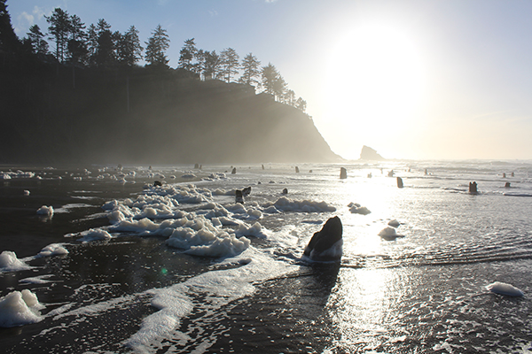
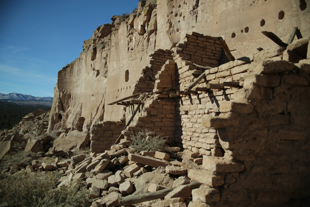
One of Cascadia’s least intuitive dangers is that the land itself may sink during the quake. NOAA’s education materials describe past events in which parts of the coast rapidly subsided by roughly three to six feet, allowing seawater to rush inland and dispatch forests rooted on what had been dry ground. That matters because subsidence changes the map immediately. Low-lying roads, neighborhoods, wetlands, and utilities can move into a higher-risk flood zone before the tsunami sequence is even finished. Unlike seasonal flooding, this is not a temporary overflow. It is a sudden reset of elevation.
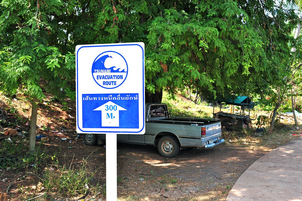
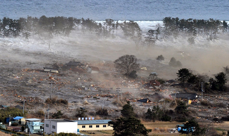
5. Tsunami timing may be measured in minutes, not hours
For distant tsunamis, coasts may get hours of warning. Cascadia is different. Emergency planning scenarios have long assumed the first waves could arrive in as little as 15 to 30 minutes in some places, leaving almost no time for debate, traffic, or gathering belongings. Some newer research suggests the biggest modeled waves may be overestimated in certain stretches of coastline where a continuous megasplay fault has not been found. Even so, that refinement does not erase the central fact: coastal communities would still face severe shaking followed quickly by dangerous water, debris, and currents over a period of hours.
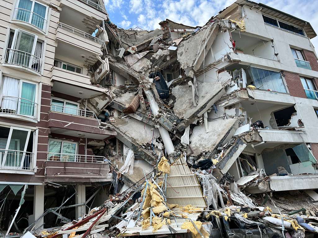
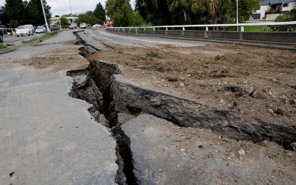
6. Cities inland face their own structural danger
The megaquake story often centers on the outer coast, but inland cities are not spectators. Seattle, Portland, Tacoma, and Vancouver may avoid the direct brunt of a tsunami in many locations, yet they remain exposed to prolonged shaking, liquefaction, bridge damage, unreinforced masonry failures, and utility disruptions. This is why Cascadia planning is not only a beach-town issue. The U.S. Geological Survey’s hazard framework for the Pacific Northwest includes megathrust, crustal, and deep intraslab earthquakes, each with different footprints and consequences. In dense urban corridors, even a smaller but closer earthquake can become a life-and-infrastructure crisis.
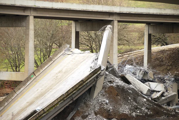
7. Bridges and supply chains are part of the hazard story
Earthquakes do not stop at fault lines; they travel through infrastructure. Regional planning material has warned that key transportation links, including aging bridges, could fail or be unusable, isolating communities and slowing medical response, fuel delivery, and freight movement. A single damaged corridor can ripple far beyond Oregon or Washington. Ports, river crossings, rail lines, and highways in the Pacific Northwest connect to national distribution systems, so a Cascadia event would also be an economic geography story, not merely a seismic one.
8. The science now includes Indigenous memory, not just instruments
Cascadia research has become stronger because it no longer relies only on modern monitoring. Oral histories from Indigenous communities along the coast describe nighttime shaking, villages destroyed by waves, and survival linked to immediate movement to high ground. Those accounts helped confirm that the 1700 disaster was not a legend detached from place, but a record of lived experience. This broader view of evidence has changed hazard science. It ties geology to memory, and memory to planning, especially in communities already working to relocate important buildings and evacuation sites to higher ground.
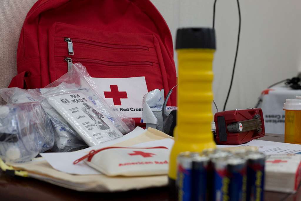
9. Preparedness still depends on what happens before the ground moves
The most repeated lesson in Cascadia planning is also the least dramatic: survival depends heavily on decisions made long before any quake begins. Seismic retrofits, vertical evacuation structures, signed routes, household supplies, and drills all matter because outside help may take days or weeks to reach badly damaged areas. The federal guidance remains simple. Secure heavy objects, plan for disrupted water and power, know local evacuation routes, and practice protective actions during shaking.
In coastal zones, the rule is even simpler: if the ground shakes hard, move to higher ground as soon as possible. Cascadia remains unsettling because it is both ancient and unfinished. Its history is written in tree rings, marsh mud, and stories that outlived the people who first told them. The region cannot control when the next major rupture comes. It can control how much of modern life is left standing when it does.

