Back-to-back atmospheric rivers have saturated western Washington, and now the region is reeling from a new round of flooding, levee failures, landslides and damaging winds. Evacuation orders and warnings are in effect for communities from King County to Skagit County as emergency crews rush to shore up defenses and protect tens of thousands.

1. Evacuations Ordered as Second Levee Breaks
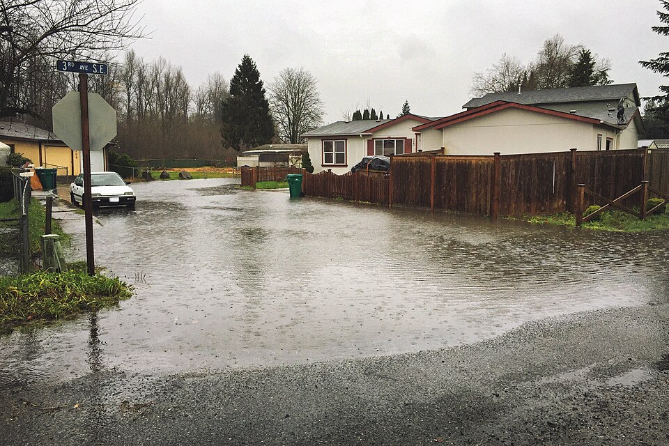
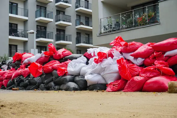
A breach in the levee along the White River forced Level 3 “Go Now” evacuations for around 2,100 residents early Tuesday morning near Pacific City Park. King County officials reported the break at about 1:30 a.m., following a 911 call from a resident whose apartment was flooding. Crews evacuated 220 homes and began placing sandbags to slow the water. “What they’re trying to do is fill as many of those sacks and get them in place as possible by 11:30 a.m.,” said King County Local Services spokesperson Brent Champaco, noting coordination with the Army Corps of Engineers ahead of planned water releases at Mud Mountain Dam.
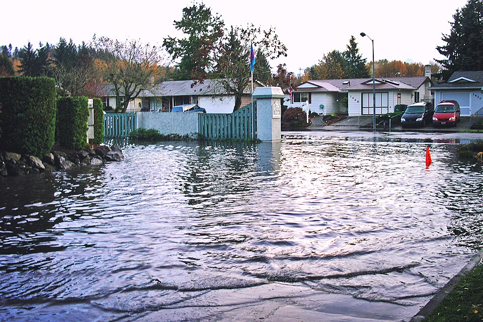
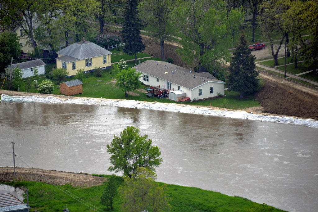
2. Green River Levee Breach Contained but Still Monitored
A break in the Desimone levee along the Green River in Tukwila on Monday had forced flash flood warnings for more than 45,000 people. It protects Tukwila, Kent, and Renton from the river. Crews finished a temporary fix by evening, and the warnings were lifted, but officials continued to monitor the situation around the clock. When the breach happened, the river was at just less than 22 feet, its highest in six decades.
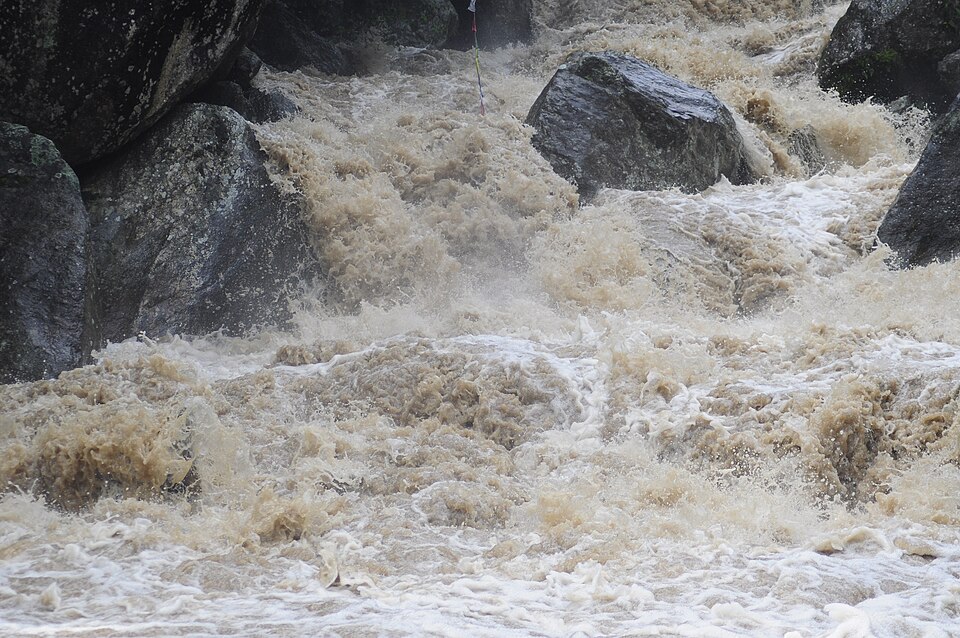
3. Rebound of Rivers with Successive Storms
Skagit River, already swollen from last week’s historic flooding, is forecast to crest multiple times this week at levels above major flood stage, 32.8 feet in Concrete and 32.81 feet in Mount Vernon on Tuesday, higher peaks are expected Wednesday and Thursday. Says the National Weather Service, additional rainfall of 2 to 6 inches will cause sharp rises in rivers, with urban and small stream flooding possible.

4. Landslide Threat Expands Across Saturated Terrain
That has been confirmed by USGS geologist Ben Mirus, who said rainfall totals have surpassed thresholds associated with past landslides, and soil moisture and groundwater levels are all running well above normal. Slides have already closed lanes on I‑90 near North Bend and damaged guardrails. State geologists are keeping tabs on several sites, including several wildfire burn scars where the soil is unstable. In Skagit County’s town of Concrete, two separate landslides have put homes in danger; several people in the Eriksen Road neighborhood were ordered to evacuate.
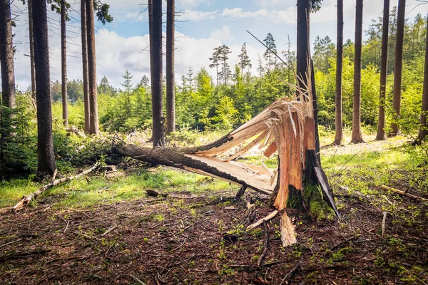
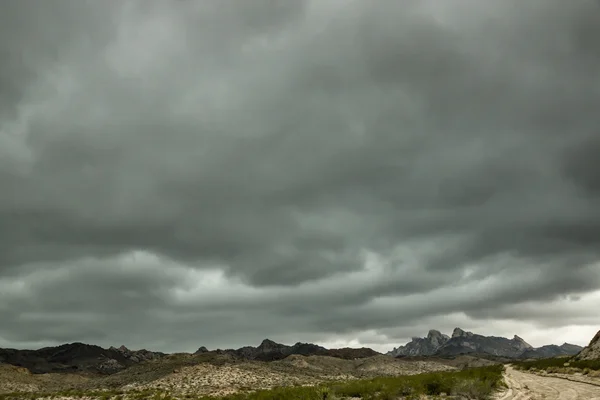
5. Wind and Snow Add to Hazards
A High Wind Watch is up for western Washington, where gusts of 50-60 mph are forecast late Tuesday night into Wednesday morning. Saturated soils will increase the risk of falling trees and power outages. In the Cascades, snow levels fall to 2,000-2,500 feet. One to three feet of snow is forecast at the passes, which will make travel very difficult.

6. Emergency Shelters and Aid Mobilized
Shelters in Pacific and Auburn are open, serving meals and offering safe refuge. The Washington National Guard has activated more than 250 members to support sandbagging, evacuations, and swift water rescues. Bloodworks Northwest has declared an urgent need for donations, stating it’s experiencing an emergency shortage of type O negative blood due to flood-related closures and cancellations.

7. Coping Emotionally With Repeated Disasters
Mental health professionals say repeated extreme weather warnings take a toll. The key to recovery is often doing what they can to maintain routine, staying in contact with neighbors, and focusing energy on practical preparedness. As Auburn resident Michael Aubrey said after floodwaters damaged his home, “When people come together, it’s a beautiful thing. That beauty can light up the darkness you may see.”
8. Practical Flood Preparedness Steps
Officials recommend that those living in flood-prone areas have sandbags ready, charge all devices in advance of wind events, and store important items in waterproof containers. Those who do not have flood insurance are at great financial risk. Secure important documents, photograph your property, and follow any recommendations for evacuation. Never drive through standing or moving water turn around, don’t drown.
9. Why Atmospheric Rivers Are Becoming More Frequent
Atmospheric rivers are long, narrow bands of moisture that transport water vapor from the tropics toward the poles. Events this month drew in moisture from as far away as 7,000 miles near the Philippines. Climate scientists point out that warming oceans and shifting weather patterns are increasing the intensity and frequency of the systems, making community resilience planning more urgent.
10. Long-Term Resilience and Infrastructure Challenges
The recent failures demonstrate that investment in flood defenses needs to be continuous. Experts caution that deferred maintenance and delays in securing funding can leave communities vulnerable. Strategies such as the reinforcement of levees, upstream water storage, and green infrastructure can reduce future risks. As meteorologist Mark Stoelinga with the Army Corps of Engineers explained, “This is not a typical weather event.
We are managing unprecedented rainfall and runoff to minimize risks to local communities.” With more storms lining up through the week, residents are advised to monitor official alerts and prepare for possible evacuations, supporting one another through forthcoming challenges.

