Tropical Storm Melissa is proving that in the Caribbean, a slow-moving system over near-record-warm waters can be far more dangerous than its early stats would suggest. With Jamaica, Haiti, and the Dominican Republic all bracing for what could become a Category 4 hurricane by early next week, the National Hurricane Center warns of life-threatening flash flooding and landslides throughout the region.

1. Current Location and Movement
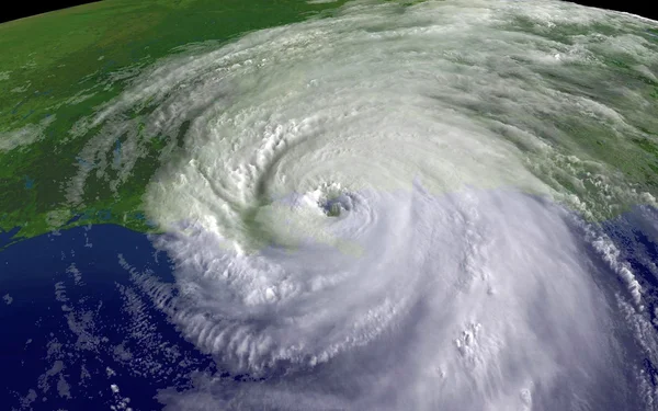
By Friday morning, Melissa hovered just over 150 miles south-southeast of Kingston, Jamaica, moving east-southeast at about 1 mph, with sustained winds of 45 mph. If these conditions persist, this rate guarantees a very extended time of heavy rain and wind for all locations in its track. Currently, forecasts indicate that the system will gradually turn toward the north and then northwest as it eventually shifts westward over the weekend, posing a continued danger to both Jamaica and southern Haiti.
2. Intensification Outlook
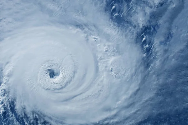
Forecasters say Melissa will experience “rapid intensification” over the next 24 hours, becoming a hurricane as early as Saturday and possibly a major hurricane as early as Sunday. The forecast predicts that sustained winds could reach as high as 145 mph, making Melissa a Category 4 storm. That explosive growth is fueled by some of the hottest ocean water in the world for late October, with sea surface temperatures averaging 0.9°F above historical norms.

3. Rainfall and Flooding Risks
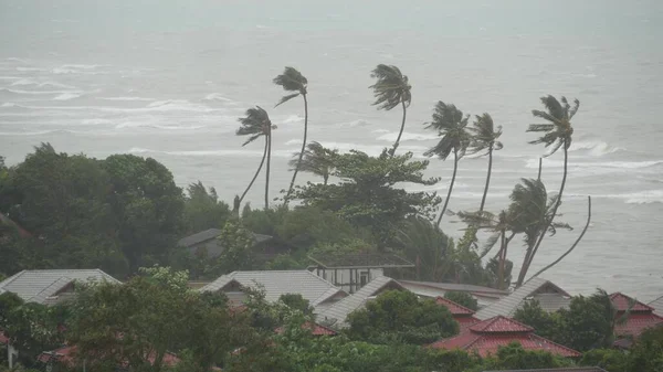
Rainfall projections are sobering: 8 to 14 inches for southern Haiti, southern Dominican Republic, and eastern Jamaica through Sunday night, with locally higher amounts possible. In saturated areas, even moderate rainfall can trigger landslides, but Melissa’s totals could lead to catastrophic outcomes. “Rainfall has historically been the biggest cause of loss of life of tropical storms and hurricanes in the Caribbean,” said Michael Brennan, director of the National Hurricane Center.

4. Historical Lessons
Similar late-season storms have also ravaged the Caribbean. Hurricane Matthew in 2016 wrought $16 billion in damage and took 731 lives, while Hurricane Mitch in 1998 became the deadliest Atlantic hurricane of the satellite era with more than 11,000 confirmed fatalities. These events represent the danger of slow-moving systems that dump massive amounts of rain over vulnerable terrain.

5. Preparedness Guidance
NOAA urges residents to take action now:
- Evacuation Plan: Identify safe routes and destinations, including out-of-town meeting points.
- Disaster Supplies: Stock food, water, medications, and batteries for at least several days.
- Insurance Checkup: Make sure coverage is in place for wind and flood damage. Remember, flood insurance has a 30-day waiting period.
- Home Strengthening: This includes tree trimming, storm shutter installation, and sealing wall openings that can help reduce wind and water intrusion.

6. Psychological Readiness
Storm preparation isn’t just physical; it’s mental. Experts recommend limiting news updates to avoid anxiety spikes, setting clear communication plans with loved ones, and focusing on actionable steps rather than dwelling on uncertainty. Maintaining routines where possible can help anchor a sense of normalcy during protracted storm threats.

7. Regional Impacts and Closures
In Jamaica, schools, health centers and government offices have all closed, and hospitals have gone into “emergency mode” to clear beds. Airports remain open, but would close within 24 hours of a hurricane warning. In Haiti, fatalities and injuries are already reported, while the U.N. is preparing more than 100 emergency shelters in the south. The Dominican Republic has had widespread water system blackouts affecting more than half a million people.
8. U.S. Mainland Outlook
Most models keep Melissa east of the continental United States, but forecasters caution that shifts in steering currents could change its path. Even if it doesn’t make landfall, rough surf and rip currents could reach the U.S. East Coast next week. AccuWeather’s Alex DaSilva said, “We do not anticipate any direct impacts or landfall in the state of Florida.

However, we’re watching closely.” Melissa’s slow crawl, along with its potential to rapidly intensify, makes this a minute-by-minute storm for monitoring. For the residents in its path, early action remains the most powerful defense against its escalating threats.

